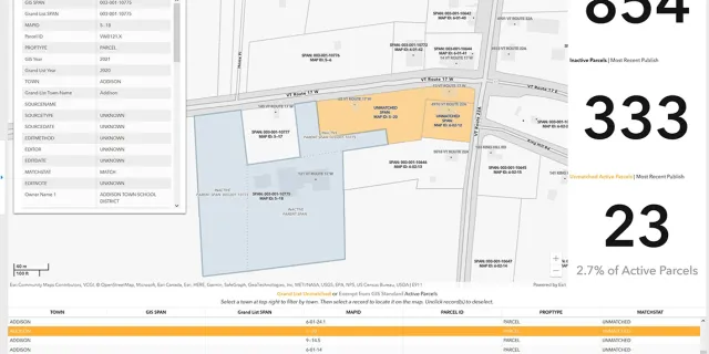
Use the match status tool to find unmatched parcels in your Town.
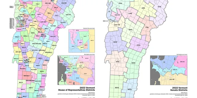
See the updated bounds of Vermont's House of Representatives and Senate districts.
2021 30cm Imagery Products Covering Essex, Orleans and Caledonia Counties Are Now Available
Reflecting on GIS work in Vermont by State Agencies and partners in this past year.
Updates to statewide broadband access datasets published by the Public Service Department are available at the Vermont Geodata Portal.
Population change in Vermont and implications for legislative reapportionment.
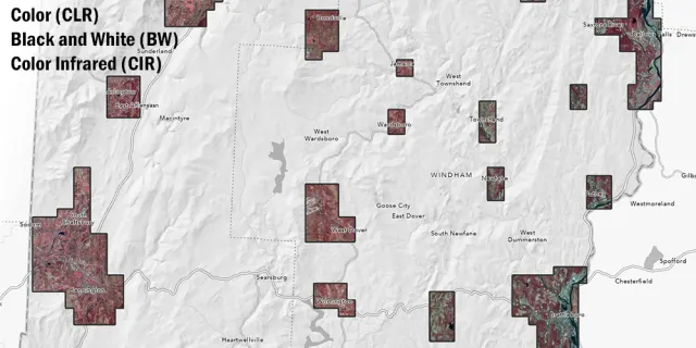
Grab the latest Vermont orthoimagery, captured in Spring 2020.
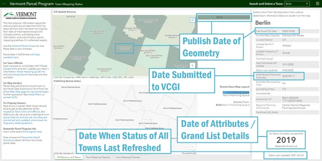
Learn more about the upkeep of Vermont parcel data.
Be sure to check your referenced services to keep the VT parcel data flowing.
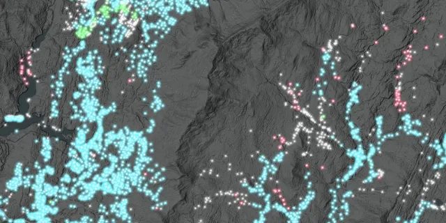
QL2 lidar-derived raster data product that conveys height of feature above ground now available throughout Vermont