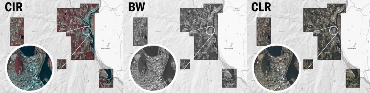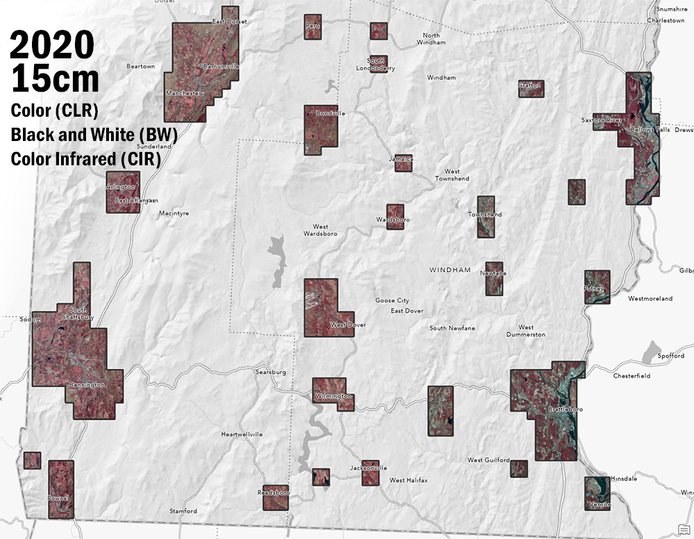
The Vermont Imagery Program is pleased to announce the availability of 2020 imagery at 15cm ground sample distance for select “buy-up” areas in Southern Vermont. These areas are now available for use as data downloads or via streaming web services for a variety of GIS and mapping projects. As usual, imagery are available in three flavors: color (CLR), color infrared (CIR), and black and white (BW), in both Vermont State Plane (SP) and web mercator (WM) projections. This collection marks the completion of the 2016-2020 5-year statewide imagery collection cycle, with a new cycle beginning in 2021.
The imagery is available for download and as imagery services from the imagery page at the VT Open Geodata Portal. The following items are now available and/or updated:
- 2020 Downloads
- 2020 Imagery Services
- “Best Of” Imagery services now include the 2020 collection
- “All Imagery” services now include the 2020 collection
Learn more about the imagery program here. Find Vermont orthoimagery available for your area using the VT Ortho Finder.