Vermont’s Statewide Parcel Program aggregates municipal parcel data into a uniform, accessible data layer joined with grand list information. Parcel data have thus become used for many purposes, ranging from fast identification of public information via the Vermont Parcel Viewer or SPAN Finder, to streamlining otherwise complicated processes via tools such as ANR’s Permit Navigator. A parcel’s unique SPAN number allows this magic to happen – it enables geometry to be joined with the correct corresponding grand list entry. If there’s no SPAN, there is no grand list entry for those parcel(s) displayed.
The Vermont Municipal Parcel Map Status application (overview here) now includes a tool for stewards of their municipal parcel data to find, review, and ideally—improve—their attribution.
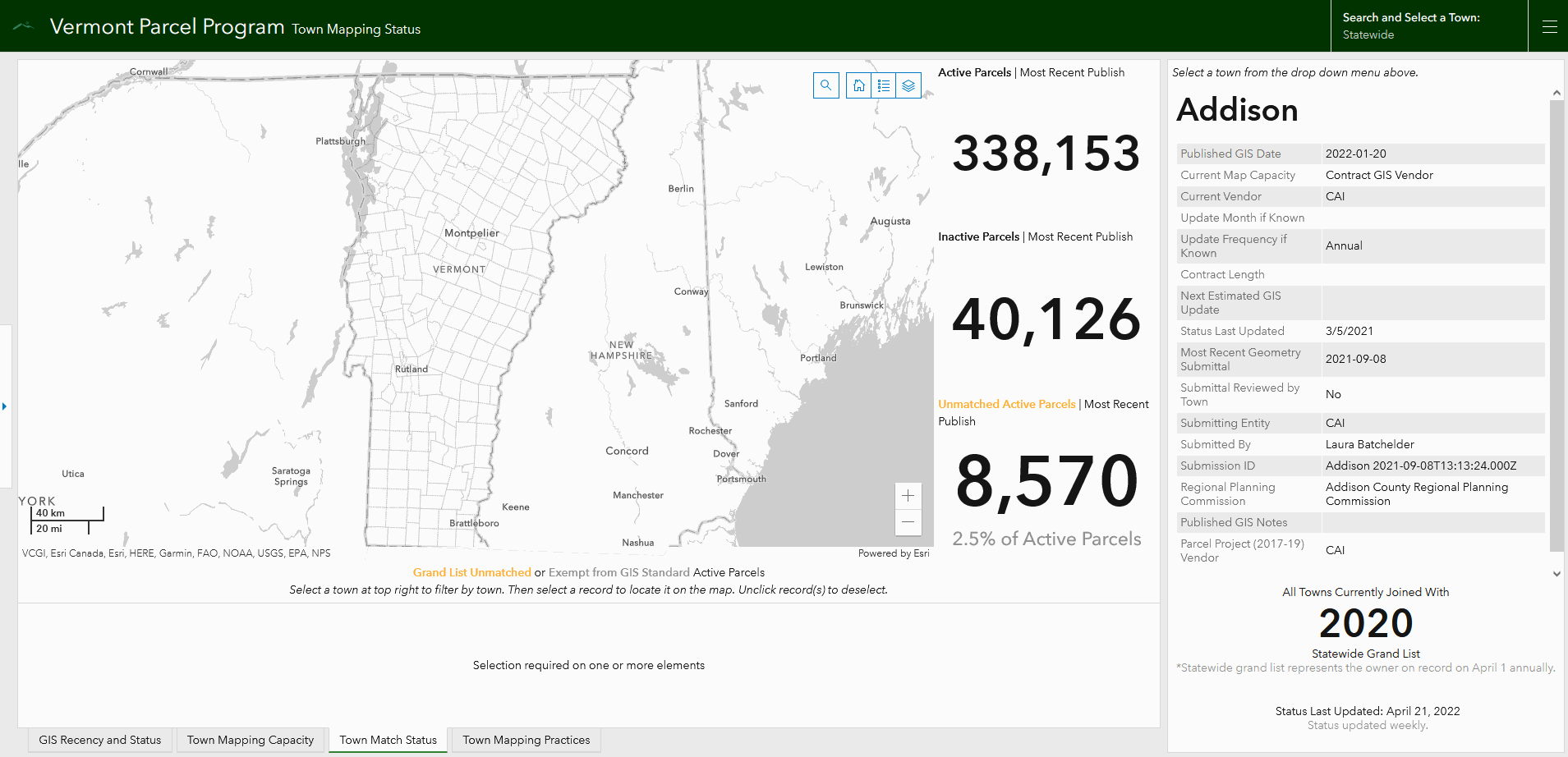
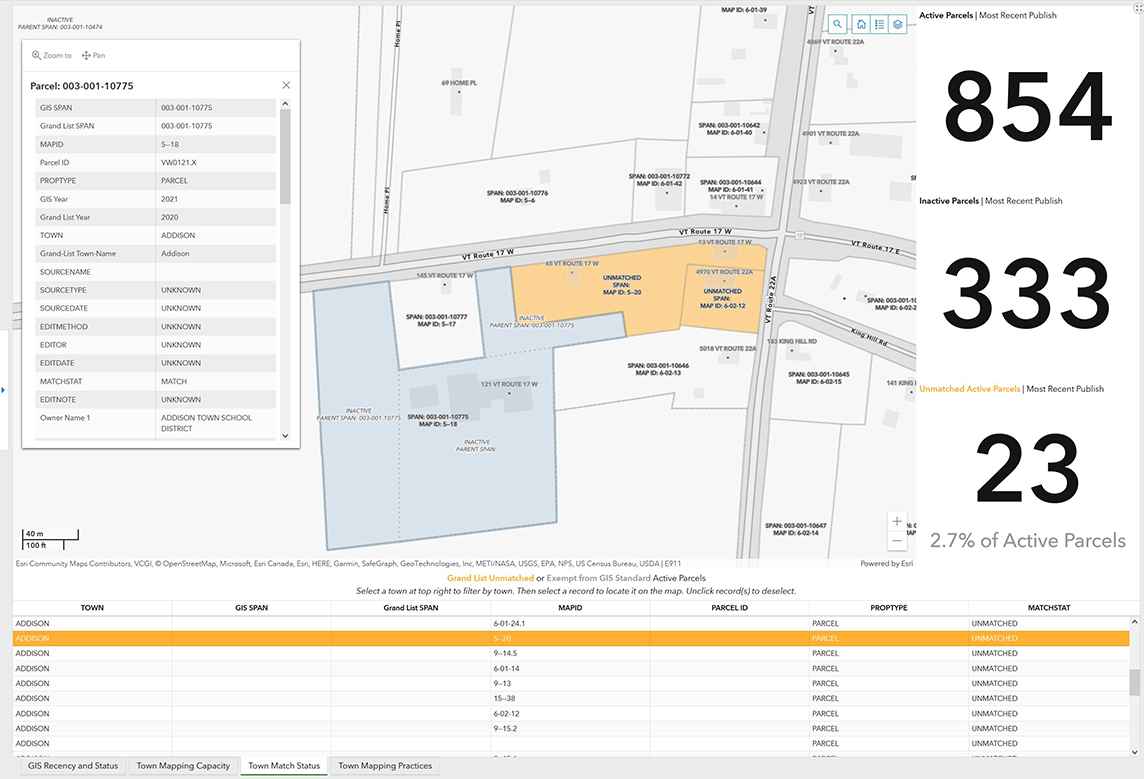
Figure 1: The Town Match Status tab within the Town Mapping Status app now enables finding unmatched parcels by Municipality as reflected in currently published parcel data.
Reviewing Match Status
Although VCGI encourages towns and their mapping vendors to review updates together before submitting them to be published, such review may not occur. This may lead to more parcels without proper attribution that in turn do not join with the grand list.
The Town Match Status tab enables municipal stewards of data to:
- see parcels that are without a grand list match highlighted in orange on the map which represents missing SPAN assignment
- confirm SPANs for these parcels and keep a running list of required changes
- note any misattributed parcels in terms of those exempted from the parcel data standard (e.g., rights-of-way, waterbodies—shown on the map in grey) and add to a running list of required changes as needed
- send information on changes to their map vendor/maintainer to be incorporated in subsequent geometry updates sent to VCGI; and
- see counts of currently published active and inactive parcels, as well as percentage of unmatched parcels for their town within statewide parcel program data*
*Note: As geometry updates and grand list updates are on different timelines, unmatched parcels may increase in count as the time between the latest published geometry update and grand list join grows. Assuming they have assigned SPANs, these parcels that have been created since the last grand list join will be fully joined once the next grand list becomes available from the Tax Department.
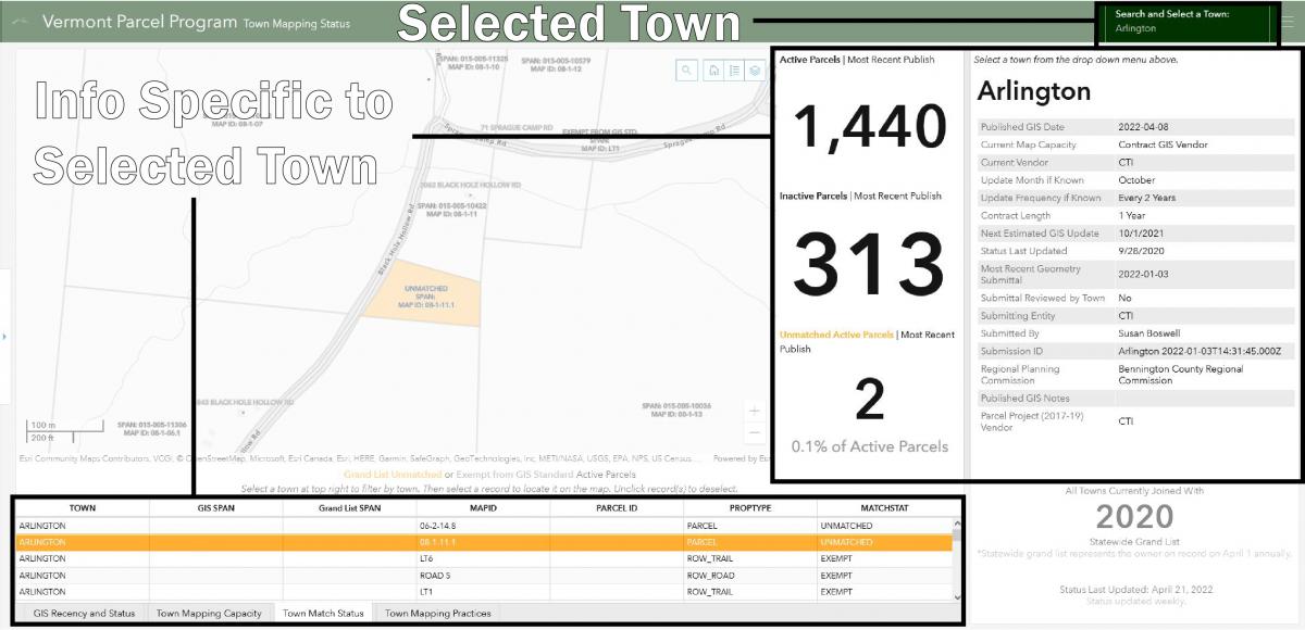
Figure 2: Elements of the Town Match Status Tab, highlighting those devoted to displaying information by selected Town using Arlington as an example.
- Click the new tab along the bottom of the application titled Town Match Status
- The data displaying on this tab is statewide by default.
- Click the “Search and Select a Town:” selector at the top right to filter and view data by an individual Town.
- Once a Town is selected, the display will update to show their currently published count of active parcels, inactive parcels, unmatched parcels, map maintenance status on the right, and table of unmatched and exempt parcels on the bottom.
- Empty cells in the bottom table reflect no information for those parcels in VCGI's received and published data.
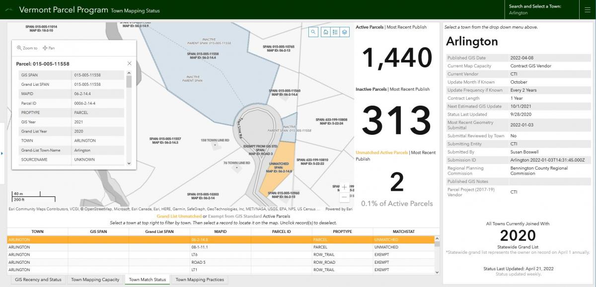
Figure 3: Selecting active parcels by clicking on them in the map highlights their extent in blue and displays any inactive parcels contained within them. In this example, parcel with SPAN 015-005-11558 has 3 associated inactives, two of which are attributed with a Parent SPAN, and the other not.
- With a Town selected at the top right, navigate either the map or the table at the bottom to see parcels with missing or incorrect information.
- Selecting active parcels by clicking on them in the map displays any inactive parcels contained within them, along with that parcel’s attributes in a pop-up window
- Clicking on a row in the bottom table will select/deselect that parcel on the map and also zoom to its location.
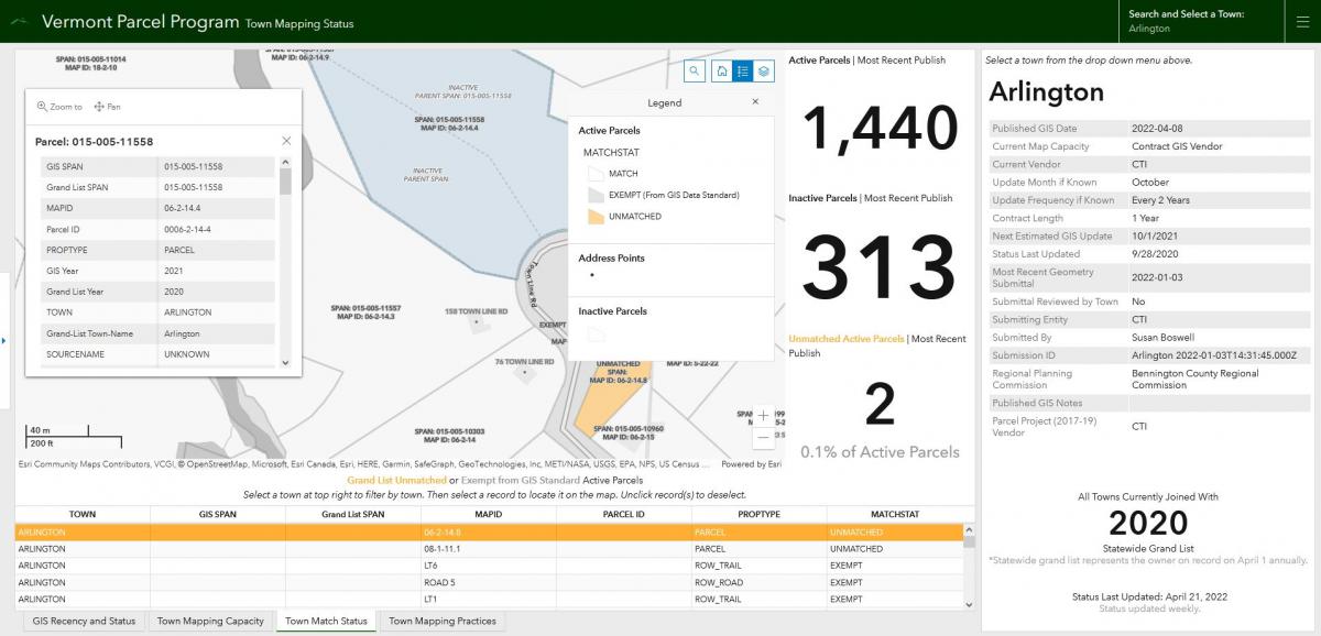
Figure 4: Viewing a map legend is possible by toggling off/on the highlighted blue button above.
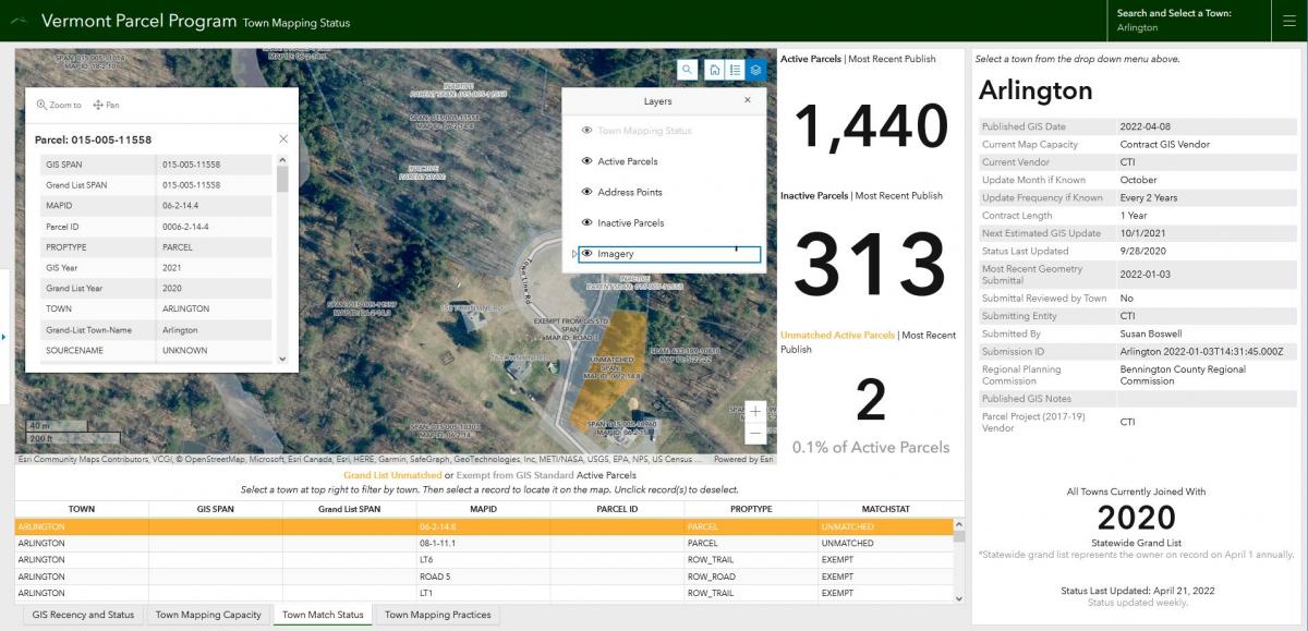
Figure 5: Turning on/off map layers is possible by clicking on the eye icon within the layers list highlighted in blue. Aerial imagery, for example, is turned off by default, and can be toggled on by clicking the eye icon to the left of the “Imagery” layer as in above.
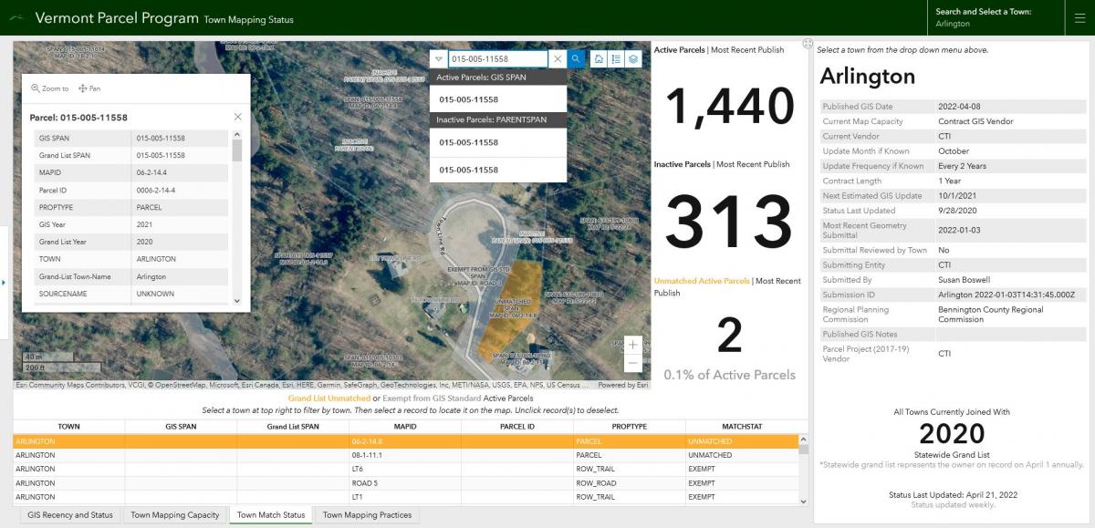
Figure 6: The map is also searchable by address and SPAN, with a unique SPAN returning both its active parcel and any associated inactives that are attributed with it as a parent SPAN.
Related Resources
Town Parcel Mapping Status Dashboard
Understanding Town Parcel Data Status
Parcel Data in GIS Format at the Vermont Open Geodata Portal