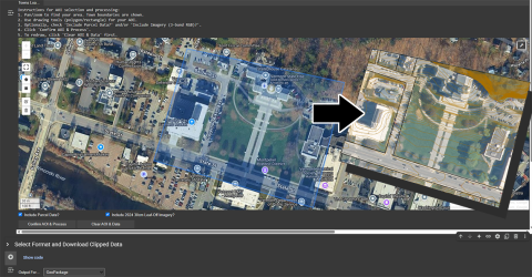
New Tools for Clipping Custom Extents of Imagery and Contours Now Available Application Release Wed, 05/28/2025 - 12:00 Two ways to clip custom extents of orthoimagery and lidar-derived contours in-browser are now available. Read more about New Tools for Clipping Custom Extents of Imagery and Contours Now Available
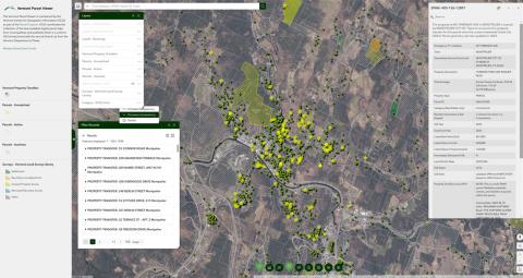
New Vermont Parcel Viewer Now Available Application Release Wed, 04/24/2024 - 12:00 An updated parcel viewer with property transfers, land suveys, and more is now available for use. Read more about New Vermont Parcel Viewer Now Available
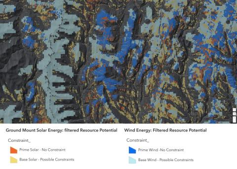
Act 174 Statewide Energy Planning Data Updated: Known and Possible Constraints, Renewable Energy Potential Data Release Fri, 03/10/2023 - 12:00 Known and possible constraint layers updated statewide, solar and wind energy potential resources available Read more about Act 174 Statewide Energy Planning Data Updated: Known and Possible Constraints, Renewable Energy Potential
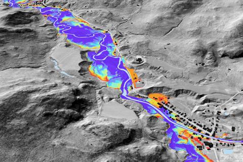
Lake Champlain Basin Lidar-Informed Flood Inundation Layer Now Available Data Release Mon, 05/23/2022 - 12:00 QL2 lidar-derived raster data product that depicts flooding extents for the Lake Champlain Basin in Vermont. Read more about Lake Champlain Basin Lidar-Informed Flood Inundation Layer Now Available
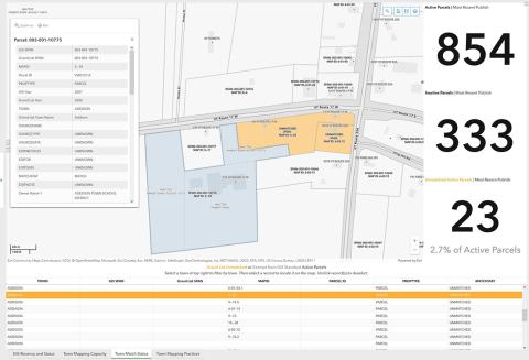
Improving Parcel Data Quality: Reviewing Match Status How-To Fri, 04/22/2022 - 12:00 Use the match status tool to find unmatched parcels in your Town. Read more about Improving Parcel Data Quality: Reviewing Match Status
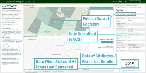
Understanding Town Parcel Data Status Application Release Thu, 04/01/2021 - 12:00 Learn more about the upkeep of Vermont parcel data. Read more about Understanding Town Parcel Data Status
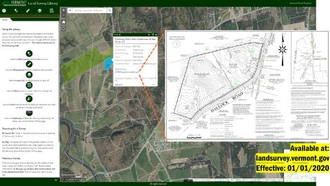
Vermont Land Survey Library Now Available for Use Press Release Wed, 01/01/2020 - 12:00 Online library hosts digital copies of land surveys of boundary line adjustments and subdivisions as prepared by Vermont licensed land surveyors Read more about Vermont Land Survey Library Now Available for Use