VCGI is pleased to announce the availability of two new tools for clipping custom extents of select raster and vector data within your web browser. These tools enable one to draw a custom area of interest (AOI) and export data for download from only those areas in several file formats.
The VT Raster Clipper replaces the former Clip and Zip tool for custom raster (imagery) clipping. The VT Contour Clipper supplements the existing Clip and Zip Tool for Contours, which will remain available. The VT Raster Clipper and VT Contour Clipper are preliminary releases that may gain additional functionality in time.
VT Raster Clipper
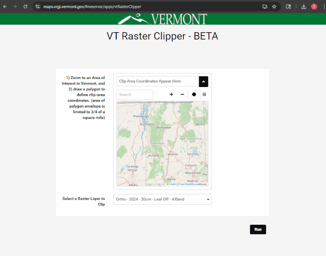
The Vermont Raster Clipper enables one to draw an AOI on a map anywhere in Vermont and export orthoimagery and select lidar-derived elevation products for the drawn area.
Using the VT Raster Clipper
Open the VT Raster Clipper in a tab of a modern web browser.
Use the map to zoom to an area of interest in Vermont. You may also expand the map view via the “Pop Out” option in the top right menu:
Once navigated to an area of interest, use the draw polygon tool (the black hexagon icon) to enclose the area you want to clip an image to. Click the first point to close the area of interest. Note: the area of the polygon must be less than ¾ of a square mile (about 480 acres).
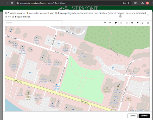
Once an AOI is drawn, click “Confirm”, verify the imagery or elevation dataset you wish to clip in the “Select a Raster Layer to Clip” drop down menu, and then click “Run” to process the request. Once complete, a zipped GeoTIFF file of the drawn area will be downloaded to your machine.

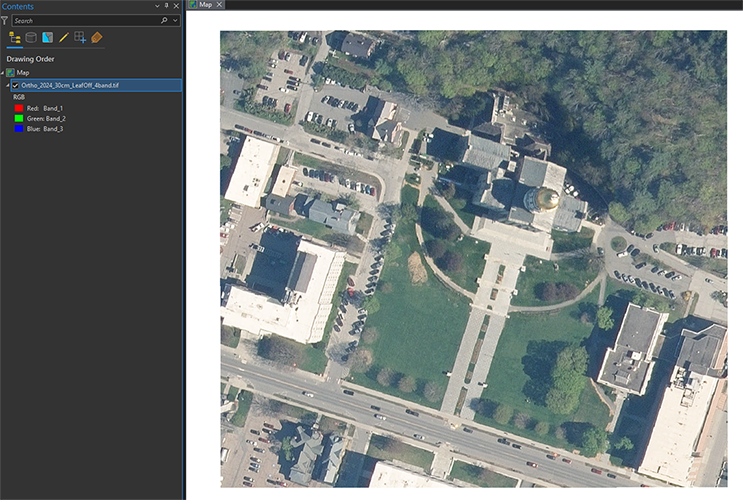
Example clipped output:
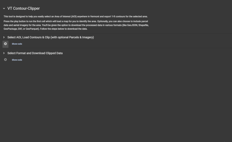
VT Contour Clipper
The Vermont Contour Clipper enables one to draw an area of interest (AOI) anywhere in Vermont and export 1-foot lidar-derived contours for the drawn area. Optional parcel geometry and the best available leaf-off orthoimagery are available to download at the same time for the drawn AOI.
Using the VT Contour Clipper
The easiest way to use the VT Contour Clipper in a web browser utilizes a free platform called Google Colab. Use of Colab requires a free Google account. Alternatively, advanced users may run the Jupyter Notebook that is the VT Contour Clipper in another environment. The following guide displays use of Colab to run the clipper.
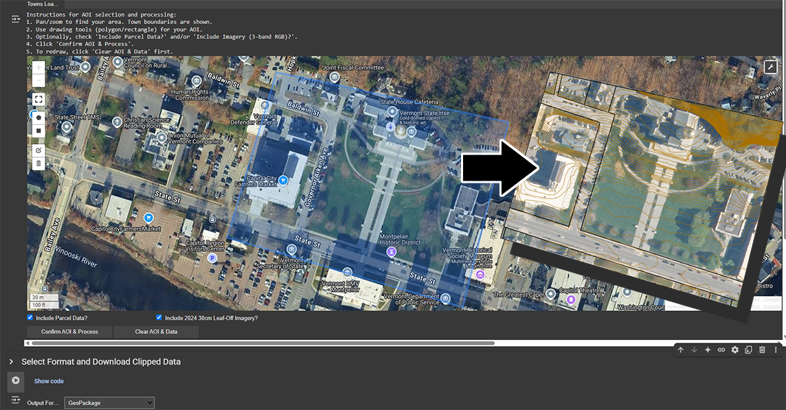
Once logged in with a Google account, open the VT Contour Clipper in a in a tab of a modern web browser. The tool has two parts – drawing the area of interest and then downloading the drawn area in an available file format. Run the first part by clicking on the “play” button:
The script will load the available data, which may take a few moments. Once the map window appears, zoom to an area of interest and use the “Draw a rectangle” or “Draw a Polygon” tool on the left (a grey pentagon shape) to enclose an area to be clipped:
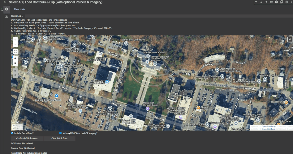
One may optionally check “Include Parcel Data” and/or “Include 2024 30cm Leaf-Off Imagery” below the map window to download those along with contours at the same time.
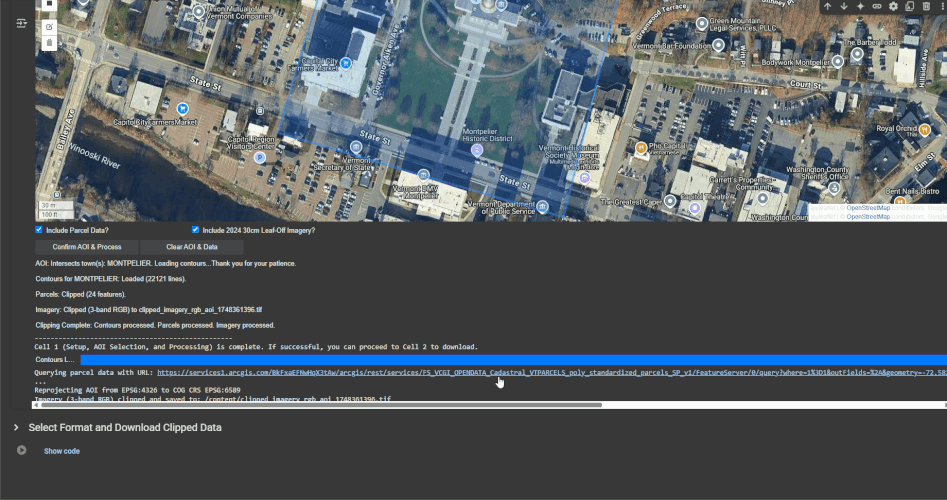
Once an AOI is drawn and data layers are selected, click “Confirm AOI & Process”. This will prepare the data to download in the next step (“cell 2”).
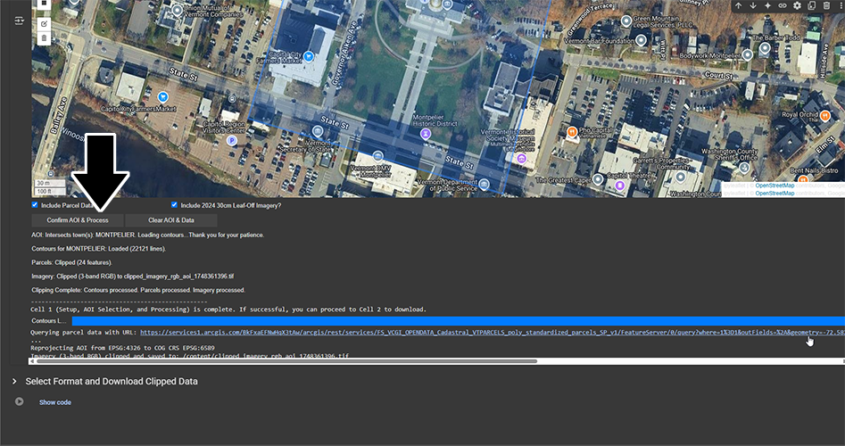
In the second part titled “Select Format and Download Clipped Data”, click the Play icon at left, then select the desired file output type from the dropdown menu, then click the “Download Data” button. This will download the selected area and layers to your machine.
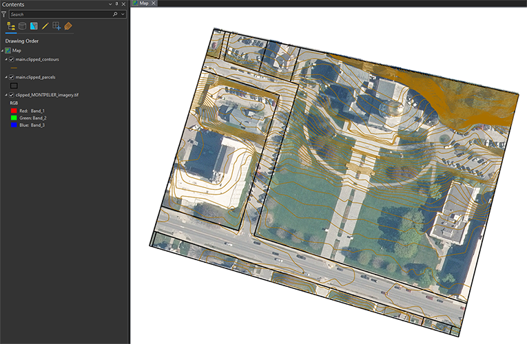
Example clipped output (includes parcels and imagery):
FAQ's
What data are available to clip in the VT Raster Clipper?
Imagery from the following collections and resolutions are currently available:
- 2024 30cm Leaf-Off 4-Band
- 2021-2022 30cm Leaf-Off 4-Band
- 2006-2010 50cm Leaf-Off 1-Band
- 1994-2000 50cm Leaf-Off 1-Band
- 1974-1992 100cm Leaf-Off 1-Band
Future imagery collections will likely be added to the tool when available.
Lidar-derived elevation data products are currently available:
- 2023 QL1 Lidar Preliminary Digital Elevation Model (DEM) – Hydro Flattened
- 2013-2017 QL2 Lidar – Aspect
- 2013-2017 QL2 Lidar – Digital Elevation Model (DEM) – Hydro Flattened
- 2013-2017 QL2 Lidar – Digital Surface Model (DSM)
- 2013-2017 QL2 Lidar – Hillshade
- 2013-2017 QL2 Lidar – Normalized Digital Surface Model (nDSM)
- 2013-2017 QL2 Lidar – Slope
Future lidar-derived products will likely be added to the tool when available.
What data are available to clip in the VT Contour Clipper?
- Best-Available Statewide Lidar-derived 1-foot Contours (2013-2017 QL2 Lidar-derived 1-foot Contours currently)
- Best-Available Statewide Standardized Parcel Data
- Best-Available Leaf-Off Orthoimagery (2024 30cm Leaf-Off 4-Band currently)
Best available parcel geometry is updated weekly. Future best-available imagery collections will likely be added to the tool when available.
What file formats are available for download?
The VT Raster Clipper outputs raster data as a GeoTIFF raster file and includes a TFW world file for those who need it.
The VT Contour clipper gives the user the option to download data in the following formats:
- Geopackage
- Shapefile
- DXF
- GeoJSON
- GeoParquet
Why doesn’t the VT Raster Clipper or VT Contour Clipper allow export of the highest-resolution orthoimagery available for a location?
The source imagery data for both applications are statewide Cloud-Optimized GeoTIFFs (COGs). GeoTIFFs are limited to a single resolution. Depending on the dataset, users will get 50cm or 30cm since that is currently the best available statewide. This is the same max resolution available in the the old clip and zip tool. Highest-resolution data remain available with tiled downloads, web services, COG downloads and/or streaming.
Why is the existing Clip and Zip tool for imagery going away?
The old Clip and Zip tool used for extracting custom extents of raster (imagery) data is no longer compatible with modern web browsers and evolving GIS data formats and as such had become increasingly unstable. The existing Clip and Zip tool for contours will remain available for use.
The new VT Contour Clipper and VT Raster Clipper applications replicate most of the functionality of the old Clip and Zip tools and add new features, while also being compatible with current browser and spatial data technologies. These technologies also permit VCGI to make incremental enhancements.
What are other ways to clip and convert GIS data?
If one is open to not using an in-browser tool such as those described here, the free QGIS software is a powerful desktop GIS client that can do more with clipping custom areas and exporting to different data formats.
For example, cloud-optimized GeoTIFF’s are streamable, clippable, and exportable to many different file formats in QGIS, as explained in this How To Use Cloud Optimized GeoTIFF’s post.