2016’s Act 174 (S.260) (As Enacted PDF | Summary PDF) seeks to improve planning for energy and land use, enabling Vermont municipalities and regional planning commissions to engage in energy planning with results that have greater weight as brought before the Public Service Board.
VCGI has assisted the Public Service Department by integrating several data sources to create updated map layers to facilitate this purpose, while also enabling improved energy siting. The input data are reflective of data snapshots taken July 2022, resulting in statewide GIS layers depicting composite known and possible constraints to energy planning, as well as municipal and building-level estimates of renewable energy potential.
Available Data Products
The Vermont Planning Atlas maintained by the Agency of Commerce and Community Development has been updated with the 2022 Act 174 layers. An Act 174-specific theme is available within the Atlas:
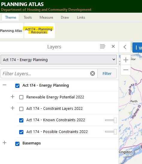
Click on the button highlighted above to access the Act174 layers in the layer list in the Vermont Planning Atlas. The user will have to expand the Renewable Energy Potential (2022) and Act174 – Constraint Layers 2022 categories (via the + button) and toggle items on (via the check boxes) to view.
Act 174 2022 GIS Layers
In addition to their display in the Vermont Planning Atlas, the following GIS data layers are available:
Data Inputs, Methods, Uses
Vermont is fortunate to have robust GIS data to build derivative products such as the Act174 content from, be they natural resources related or statewide high-resolution elevation data. In coordination with Vermont Regional Planning Commissions, The Department of Public Service, the Vermont Center for Geographic Information, and Agency of Natural Resources have created these layers that represent the best available known and possible constraints detailed in the Act 174 Energy Planning Mapping Standards for Municipal Plans. The following data inputs were relied on for the creation of both the constraints layers and the rooftop solar potential products, representing the best available information as of July 2022.
Known Constraints 2022 Layer Inputs:
- Vermont Significant Wetlands Inventory
- VSWI Wetlands Advisory Layer
- AE/VCE Confirmed Vernal Pools
- FEMA Special Flood Hazard Areas – Floodways Only
- DEC River Corridors
- Significant Natural Communities
- Rare, Threatened, Endangered Species
- National Wilderness Areas in VT
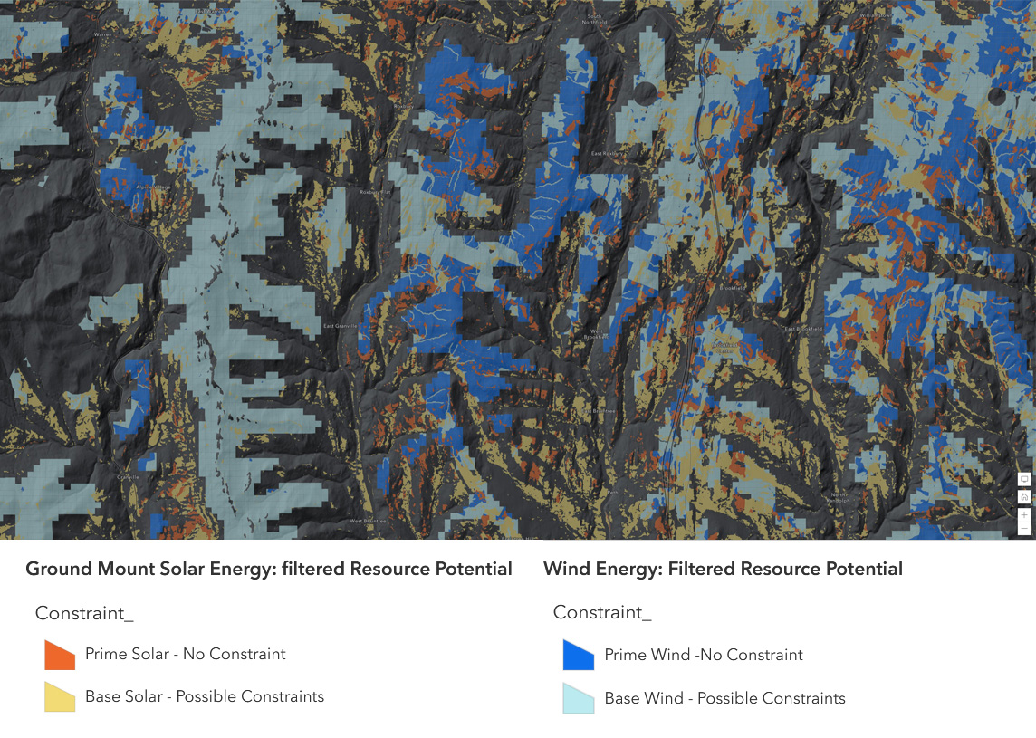
The known constraints composite layer suggests where constraints are likely, though not absolute, and thus are unsuited for development based on statewide or local regulations or designated critical resources.
Possible Constraints 2022 Layer Inputs:
- AE/VCE Unconfirmed Vernal Pools
- FEMA Special Flood Hazard Areas
- Agriculturally Important Soils
- Act 250 Agricultural Soil Mitigation Areas
- Deer Wintering Areas
- Hydric Soils
- Conservation Design Layers
- Interior Forest Blocks - Highest Priority
- Connectivity Blocks - Highest Priority
- Physical Landscape Blocks - Highest Priority
- Surface Water and Riparian Areas - Highest Priority
- Protected Lands
The possible constraints composite layer suggests where conditions would likely require mitigation, and thus which may prove a site unsuitable for development after site-specific study, based on statewide or regional/local policies that are currently adopted or in effect.
The image at the top of this post depicts the composite constraint layers.
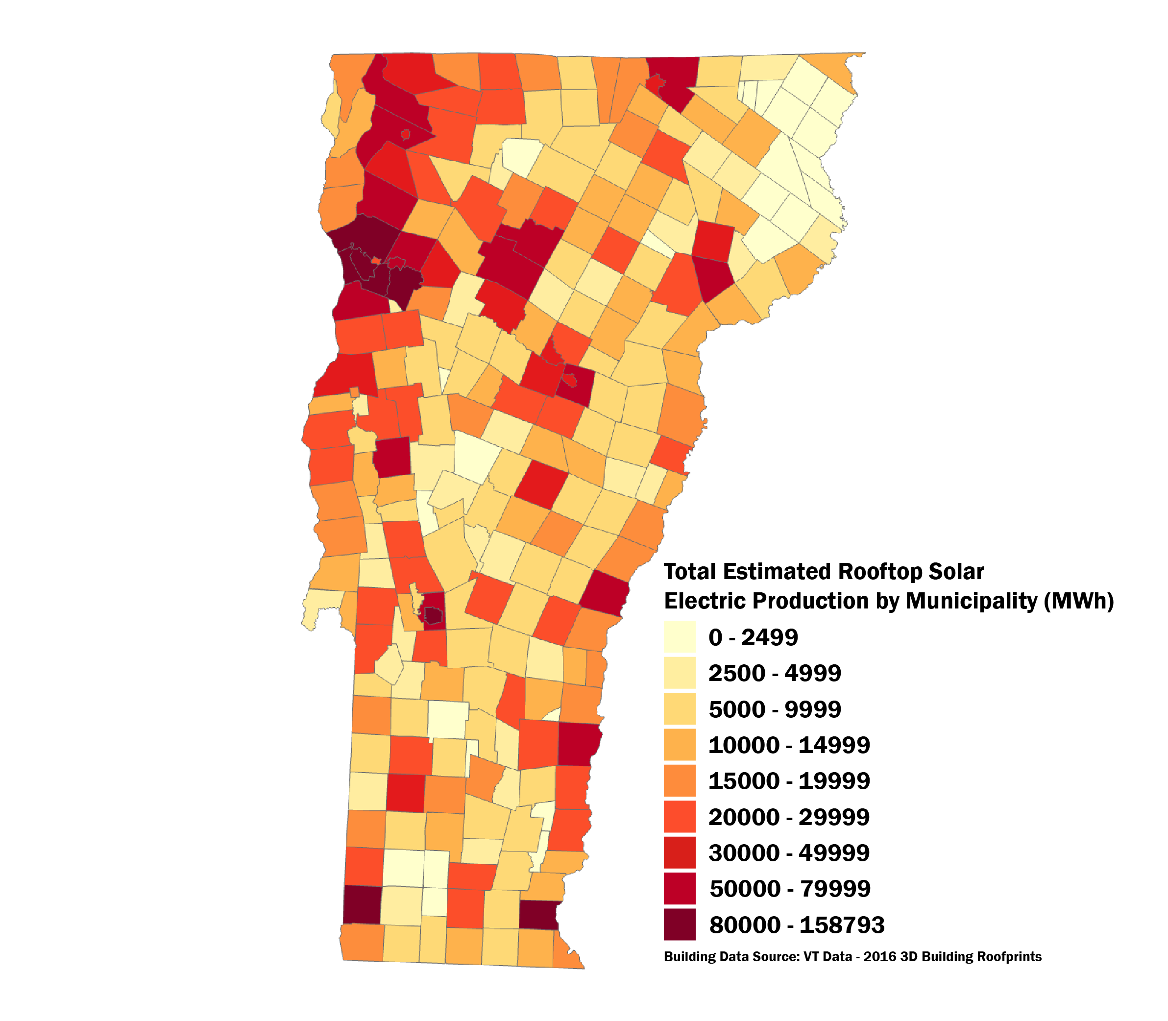
For the rooftop solar potential products, the ESRI Area Solar Radiation tool was run (workflow overview here) on the statewide lidar-derived normalized digital surface model (nDSM) with a mask on the 2016 lidar-derived building footprints. This ASR raster estimates rooftop solar potential for individual structures so they can be aggregated at the municipal level to inform Vermont's Regional Planning Commissions on rooftop solar potential.
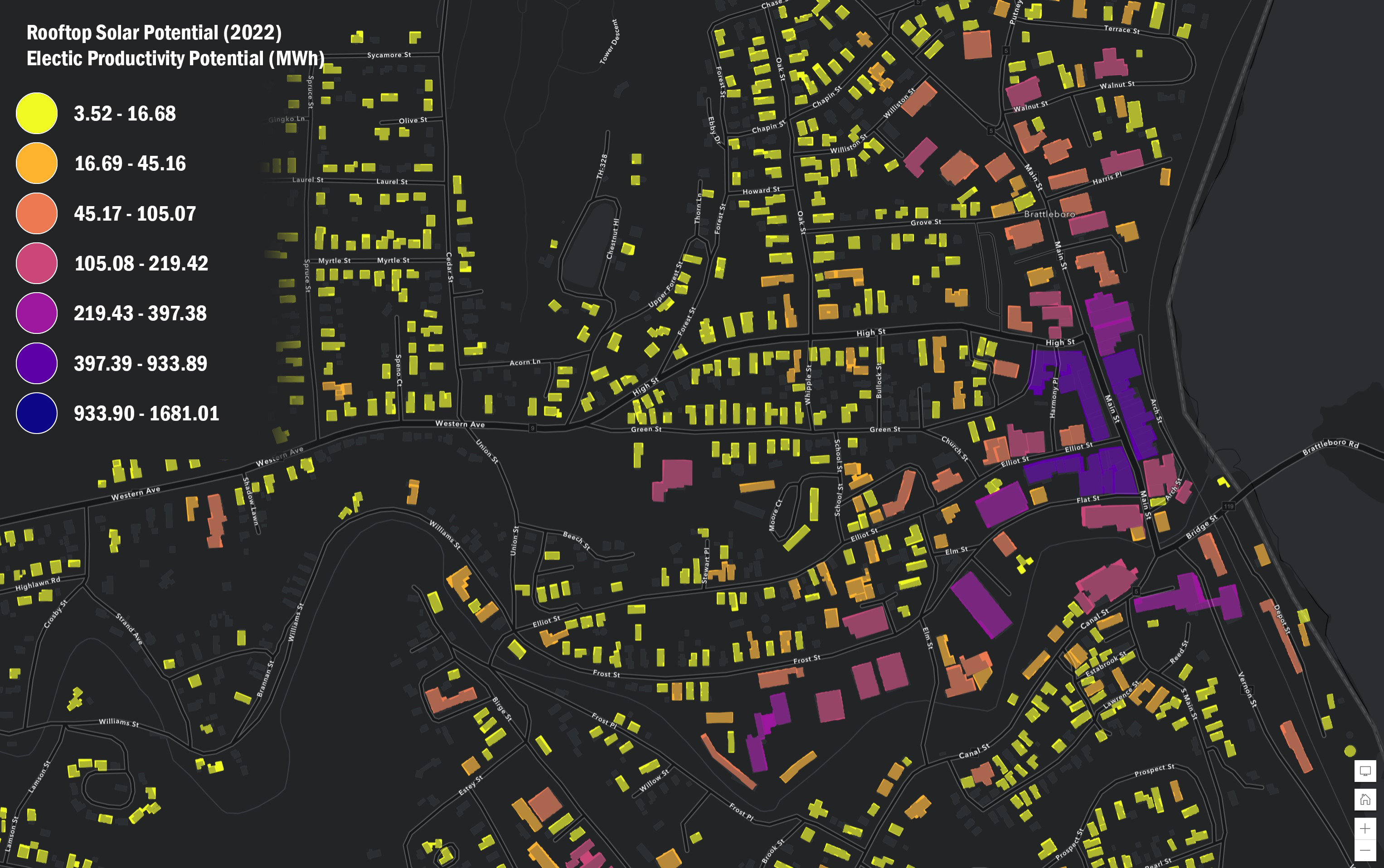
Rooftop solar potential was modeled at the individual building level using 2016 building footprint data, providing enough detail for high-level comparisons.
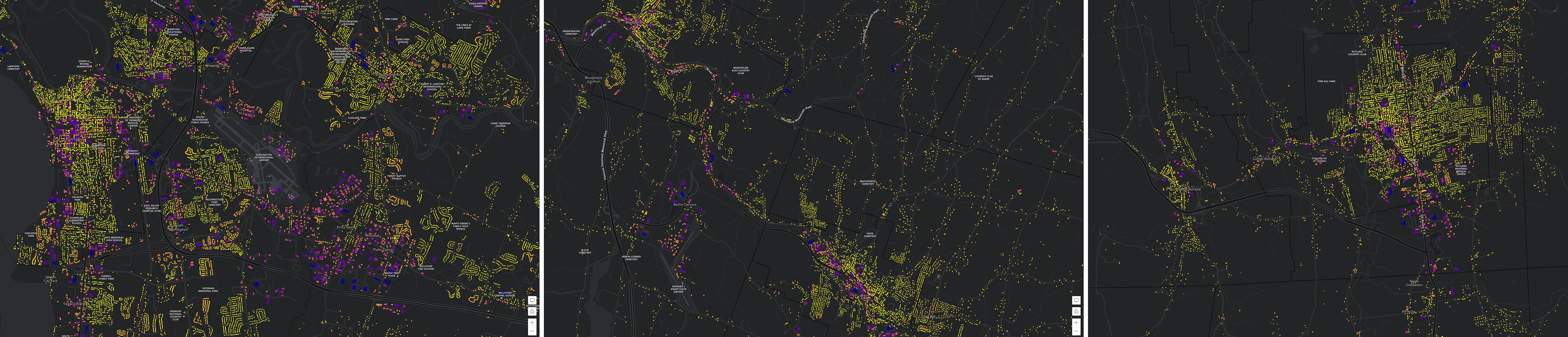
Solar potential from rooftops based on existing QL2 lidar-derived products for the Burlington area (left), Central Vermont area (center), and Rutland City (right), all shown at the same scale.
Lastly, the Town Rooftop Solar Potential layer is intended to help Regional Planning Commissions and municipal planners determine estimated total rooftop solar potential within a town or region. This layer contains summary information on the rooftop solar radiation and electric productivity potential for each town in Vermont. Units are in Megawatt hours per square meter.
Contacts
Please contact Anne Margolis of the Public Service Department for Act174 Energy Planning questions, and Steve Fugate of VCGI for map-related questions.