HTTPS Required: How To Update Broken Service URL's How-To Fri, 11/15/2024 - 12:00 Please check and update any service URL references from http:// and replace with https:// Read more about HTTPS Required: How To Update Broken Service URL's
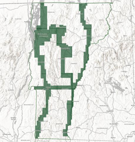
Coming Soon: Statewide QL1 Lidar Data News Wed, 12/06/2023 - 12:00 Pilot data now available. Read more about Coming Soon: Statewide QL1 Lidar Data
How To Use The Vermont Geocoding Service Version Date: April 18, 2024 Contents Overview and Purpose System Requirements How To Use Read more about How To Use The Vermont Geocoding Service
Cloud Optimized GeoTIFFs (COGs) Now Available News Thu, 04/18/2024 - 12:00 High performance cloud optimized raster data format now available for select items. Read more about Cloud Optimized GeoTIFFs (COGs) Now Available
2023 Orthoimagery Now Available Data Release Tue, 04/09/2024 - 12:00 0.15m (15cm) coverage for major transporation corridors and urban areas Read more about 2023 Orthoimagery Now Available
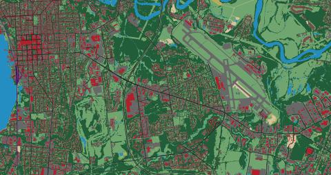
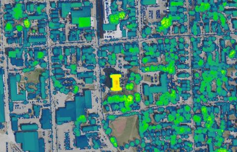
High Resolution Base Land Cover and Impervious Surfaces Layers Now Updated, Old Services Deprecated Data Release Thu, 06/15/2023 - 12:00 These 2016 high resolution land cover products have been updated. Read more about High Resolution Base Land Cover and Impervious Surfaces Layers Now Updated, Old Services Deprecated
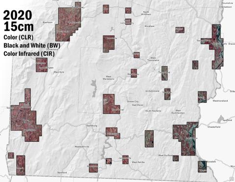
2020 Orthoimagery at 15cm Resolution Now Available Data Release Fri, 04/16/2021 - 12:00 Grab the latest Vermont orthoimagery, captured in Spring 2020. Read more about 2020 Orthoimagery at 15cm Resolution Now Available
Updates to VT Parcel Services and Retirement of Older Versions on 3/1/2021 News Fri, 02/05/2021 - 12:00 Be sure to check your referenced services to keep the VT parcel data flowing. Read more about Updates to VT Parcel Services and Retirement of Older Versions on 3/1/2021
Statewide Normalized Digital Surface Model (nDSM) Service Now Available Data Release Tue, 01/26/2021 - 12:00 QL2 lidar-derived raster data product that conveys height of feature above ground now available throughout Vermont Read more about Statewide Normalized Digital Surface Model (nDSM) Service Now Available
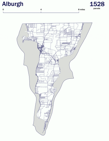
Standardized Parcels Now Available Data Release Wed, 02/20/2019 - 12:00 Updates to the statewide coverage of standardized parcel data are made as individual towns are completed. Read more about Standardized Parcels Now Available