The 2016 high-resolution statewide base land cover and impervious surfaces layers have been updated. Please note the following changes:
| Item | Summary of Changes |
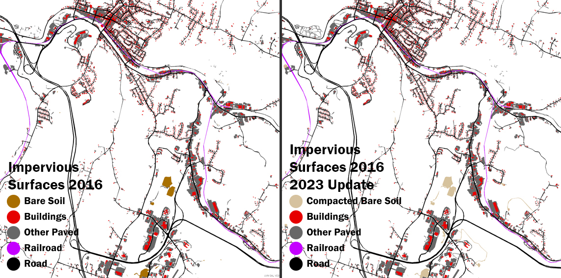
| Base Land Cover | Improved detection of impervious surfaces occurring beneath a tree canopy in forested areas. Layer includes a new "compacted bare soil" map class to better represent all of the impervious surfaces in Vermont. |
| Impervious Surfaces | Improved detection of impervious surfaces occurring beneath a tree canopy in forested areas. Includes a new "Compacted bare soil" map class to better represent all of the impervious surfaces in Vermont. The "bare soil" map class has been removed from this layer. |
Both updated layers have newly published items with new URL's for each version. Links to all items are available from and have been updated at the Land Cover page at the Vermont Open Geodata Portal.
Updated Base Land Cover 2016 | Item Overviews: (Raster Tile | Vector Tile) | Download Link (2.1 GB) | Web Mercator Service URLs (Raster Tile | Vector Tile) | Metadata
Updated Impervious Surfaces 2016 | Item Overviews: (Raster Tile | Vector Tile) | Download Link (271 MB) | Web Mercator Service URLs: (Raster Tile | Vector Tile) | Metadata
These updated items overwrite and replace the following services. Please check your projects for references to the items below and replace them with the updated services linked above. Service URLs to the older items will no longer be available in 30 days / after July 15th, 2023 per VCGI's web services life cycle policy.
Base Land Cover (Prior to Update):
Impervious Surfaces (Prior to Update):
- Cached Map Service: https://maps.vcgi.vermont.gov/arcgis/rest/services/EGC_services/MAP_VCGI_IMPERVIOUS2016_WM_CACHE_v1/MapServer
- Vector Tile Service: https://vcgi.maps.arcgis.com/home/item.html?id=a975fac5daa94f20955d5dea6c35d935
Questions?
Contact Lidar Program Manager Steve Fugate by email or phone at 802-793-6802