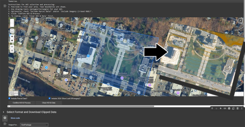
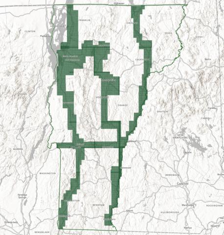
New Tools for Clipping Custom Extents of Imagery and Contours Now Available Application Release Wed, 05/28/2025 - 12:00 Two ways to clip custom extents of orthoimagery and lidar-derived contours in-browser are now available. Read more about New Tools for Clipping Custom Extents of Imagery and Contours Now Available
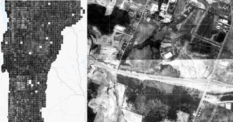
1974-1992 Georeferenced VT Orthophotos Now Available for Streaming and Download Data Release Thu, 04/17/2025 - 12:00 Scanned and georeferenced orthophotos taken over the course of 18 years are now avaliable for most of Vermont Read more about 1974-1992 Georeferenced VT Orthophotos Now Available for Streaming and Download
Input Requested: Future of the Vermont Imagery Program News Tue, 05/28/2024 - 12:00 Add your input on the future of Vermont's Orthoimagery Program Read more about Input Requested: Future of the Vermont Imagery Program
Cloud Optimized GeoTIFFs (COGs) Now Available News Thu, 04/18/2024 - 12:00 High performance cloud optimized raster data format now available for select items. Read more about Cloud Optimized GeoTIFFs (COGs) Now Available
2023 Orthoimagery Now Available Data Release Tue, 04/09/2024 - 12:00 0.15m (15cm) coverage for major transporation corridors and urban areas Read more about 2023 Orthoimagery Now Available
High Resolution Base Land Cover and Impervious Surfaces Layers Now Updated, Old Services Deprecated Data Release Thu, 06/15/2023 - 12:00 These 2016 high resolution land cover products have been updated. Read more about High Resolution Base Land Cover and Impervious Surfaces Layers Now Updated, Old Services Deprecated
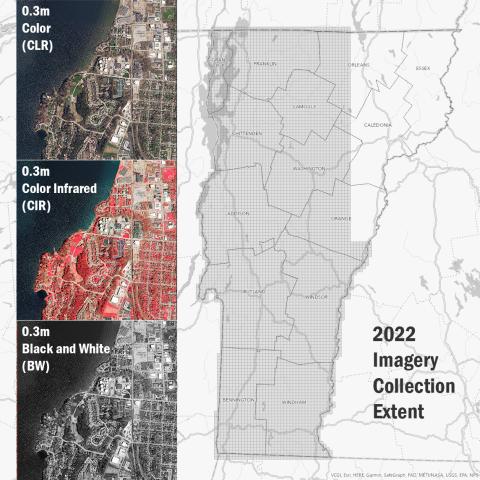
2022 Orthoimagery Now Available Data Release Tue, 02/07/2023 - 12:00 Largest leaf-off collection captured in a single season yet. Read more about 2022 Orthoimagery Now Available
2021 Orthoimagery Now Available Data Release Fri, 03/11/2022 - 12:00 2021 30cm Imagery Products Covering Essex, Orleans and Caledonia Counties Are Now Available Read more about 2021 Orthoimagery Now Available
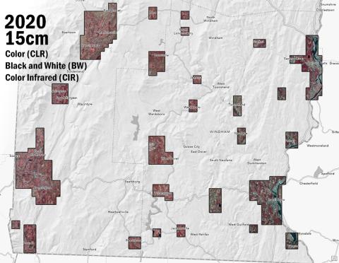
2020 Orthoimagery at 15cm Resolution Now Available Data Release Fri, 04/16/2021 - 12:00 Grab the latest Vermont orthoimagery, captured in Spring 2020. Read more about 2020 Orthoimagery at 15cm Resolution Now Available
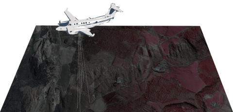
VTrans UAS Program Imagery Now Available Data Release Mon, 08/03/2020 - 12:00 High-resolution, georeferenced unmanned aircraft systems (UAS) imagery captured by the VTrans UAS program now available for select project locations Read more about VTrans UAS Program Imagery Now Available