Dataset

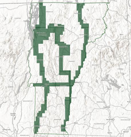
Topographically-defined Floodplains: Relative inundation for conservation and restoration planning in the Lake Champlain Basin, Vermont
The Topographically-defined Floodplains were generated from high-resolution topographic data along rivers draining greater than 2 square miles in the Vermont portion of the Lake Champlain Basin. These floodplains are intended for planning and research use by government, academic, commercial and non-governmental agencies; they are not a substitute for FEMA Flood Insurance Rate Maps and are not intended for regulatory use. A greater geospatial coverage of floodplains in the basin will support analyses of floodplain and wetland processes and restoration and conservation planning for improved water quality, enhanced flood and climate resilience, and expanded habitat and ecosystem functions. Lateral extents of flooding for storms of recurrence intervals ranging from 2 to 500 years are represented in the dataset.