Vermont's 256th Municipality, Related Geographic Area Names and Codes Standard Also Updated
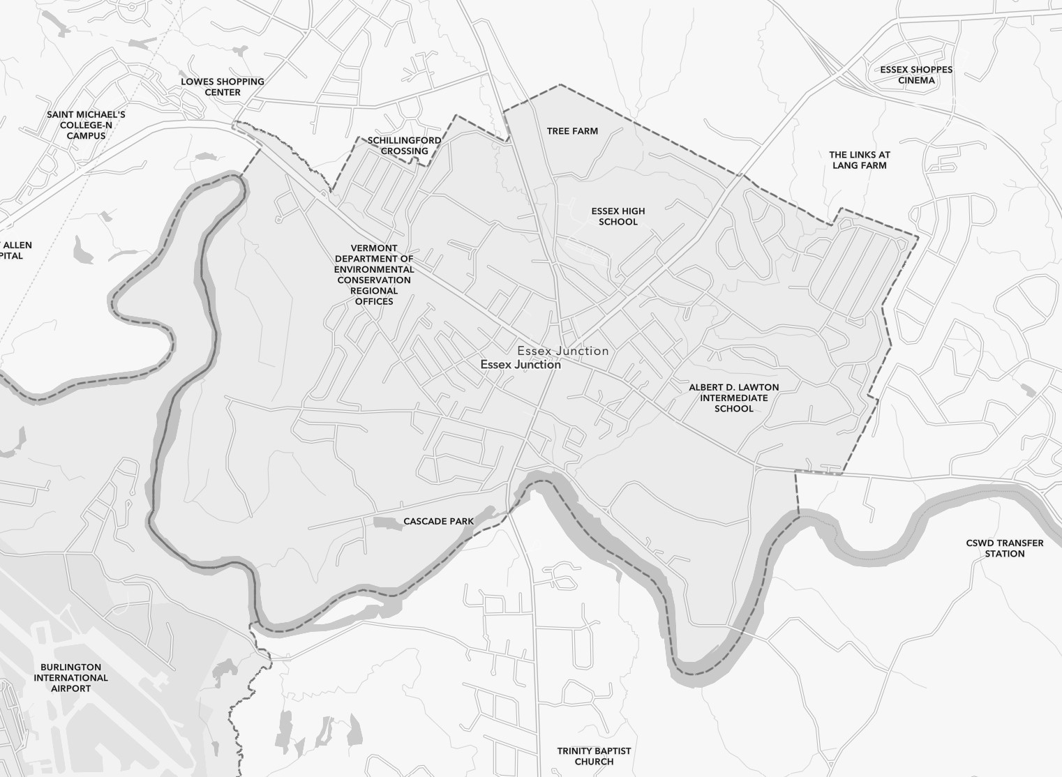
Previously an incorporated village, The City of Essex Junction officially becomes Vermont's 256th municipality (and 10th city) on July 1st, 2022.
The change is now reflected in Vermont's open spatial data layers available at the Open Geodata Portal, swapping the former village from the Vermont Village Boundaries layer to the Vermont Town Boundaries layer. No geometry changes have occurred.
The change is also reflected in web applications that display Vermont's municipalities, such as the Vermont Parcel Viewer, and Vermont's Boundaries and Jurisdictions map.
Applications referencing town boundaries via the services of any of the layers below should now see the new municipality/city.
- VT Data - Town Boundaries
- VT Data - Boundaries, All Lines
- VT Basemap, Web Mercator
- VT Basemap, VT State Plane Meters
The City of Essex Junction has not yet received a Federally-assigned unique FIPS and GEOID codes, and they will be added to these data as soon as they are available.
Updated Geographic Area Names and Codes Standard Now Available
The Vermont Geographic Area Names and Codes Standard aims to provide uniform spelling of and accounting for the current geographic entities of Vermont in digital format. The standard is accompanied by key / lookup / crosswalk tables that facilitate data uniformity and interoperability when dealing with Vermont's Towns, Cities, Counties, Villages, and Regional Planning Commissions.
A summary of changes in the June 2022 update:
- Creation of the City of Essex Junction (formerly the Village of Essex Junction). The Federally-assigned GEOID for this entity is forthcoming and will be added to the standard and data as soon as available.
- Moved Village of Essex Junction from active to “historical”
- Replaced references to the former Southern Windsor Regional Planning Commission (SW) with Mount Ascutney Regional Commission (MA)
- Inclusion of four new fields in “commcode” database:
- CENSUS2020 – flags if geographic entity was recognized in 2020 Census
- AOE_CODE – code denoting municipalities within Agency of Education data
- LAT – latitude of town clerk’s office for municipality (E911 Landmark location used in absence of town office)
- LONG – longitude of town clerk’s office for municipality (E911 Landmark location used in absence of town office)
The document has also been renamed from VT Geographic Area Codes Standard to VT Geographic Area Names and Codes Standard.