Aerial imagery in Vermont acquired from 1962, 1963 and 1964 is now freely available in two different datasets at the VT Open Geodata Portal:
- The 1962 “H” collection consists of 5,895 scanned, non-georeferenced 1:18,000 scale black-and-white aerial photos with coverage of the entire state.
- The 1962 “L” collection is comprised of select areas of the state with 2,339 scanned black-and-white aerial photos available at 1:6,000 scale. These 2,339 photos are provided in addition to the 957 scanned and georeferenced 1962 aerial photos already available in the “L” collection.
- All new scans in both “H” and “L” collections are not georeferenced or orthorectified and are available as .jpg’s only.
The Vermont Agency of Transportation’s Highway Mapping Unit scanned the analog photo prints and has graciously shared them with VCGI for the purposes of making them available to the public. Read more about the 1962 imagery in their metadata (1962 “H” collection) (1962 “L” collection), learn more about historical aerial imagery in Vermont in general from this post at our Medium page, or get a preview of their contents below.
For enterprising individuals, we’ve recently published a guide to georeferencing historical imagery using free QGIS software. We hope you enjoy these historical imagery resources, and as always, happy mapping!
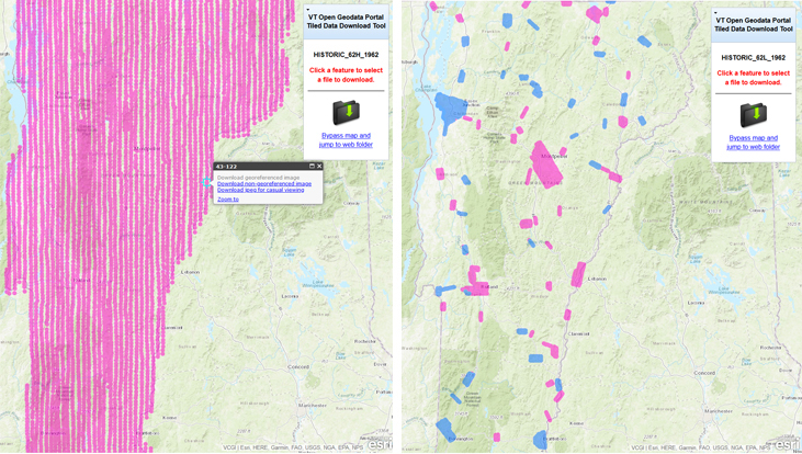 The 1962 “H” collection (left) offers statewide coverage with images acquired in 1962, 1963, or 1964. The 1962 “L” collection (right) contains images acquired in 1962 or 1963 with coverage for select areas of Vermont. The "L" collection contains both non-georeferenced imagery (pink index markers) and georeferenced imagery (blue index markers).
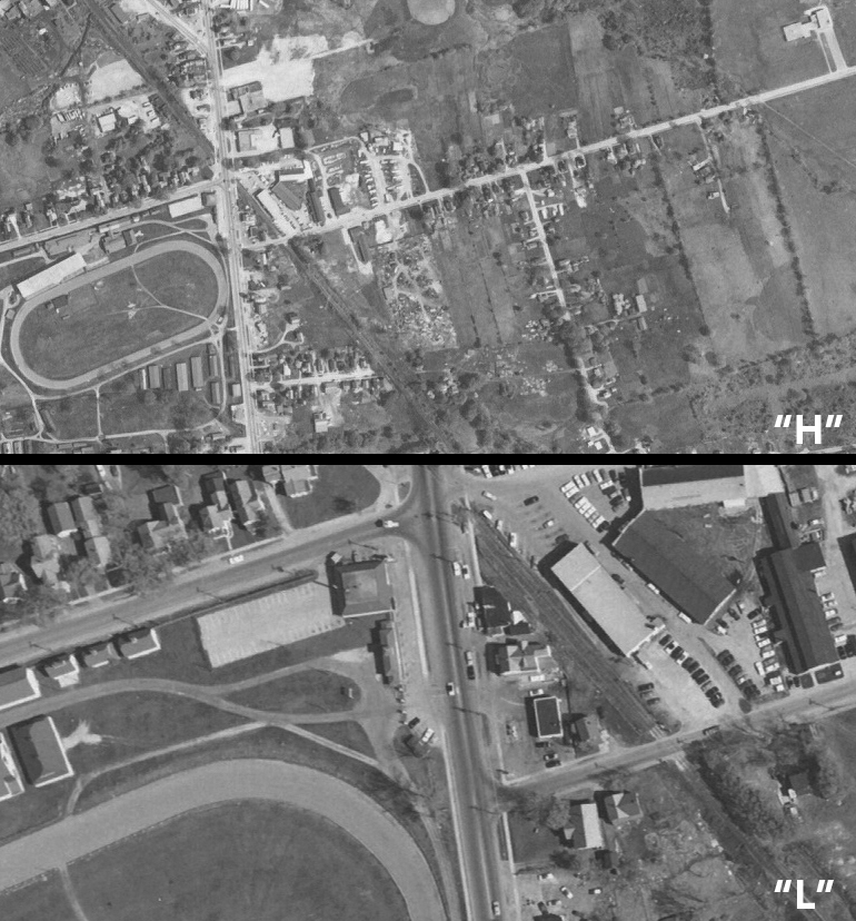 A scale comparison of the same general location between the higher "H" collection at 1:18,000 (top), and lower "L" collection at 1:6,000 scale (bottom).
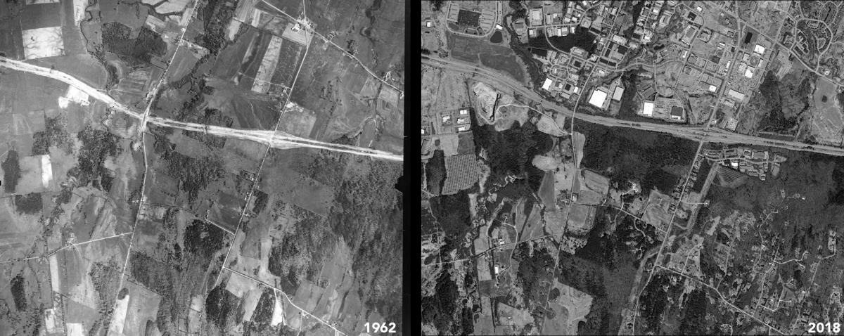
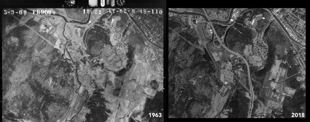 The 1962 collections are useful for depicting changes in the Vermont landscape. For example, much of what is now Interstate 89 was under construction at the time of the image on the left taken on May 3, 1963 near present-day exit 8 in Montpelier. The same area is shown in 2018 Black and White imagery on the right. Note the imagery information on the scanned photo, complete with flight info around its border. Early metadata!
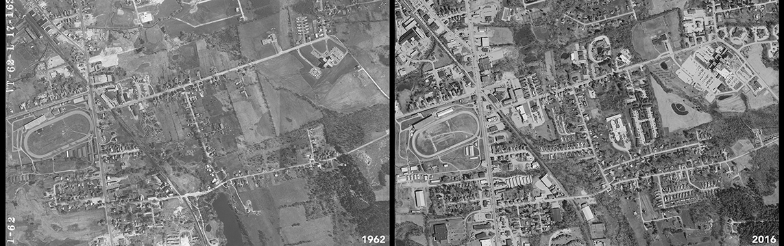
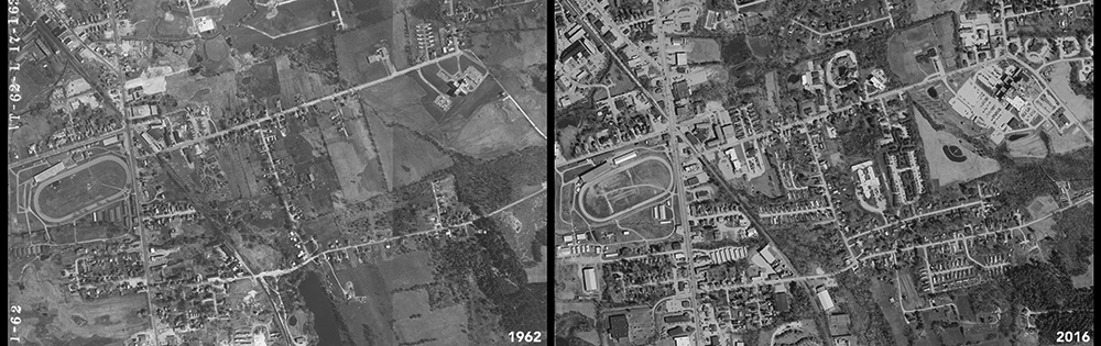 Some locations reveal easily identifiable features, such as the Vermont State Fairground complex in Rutland in the left image as seen from above in 1962. The Rutland Regional Medical Center found at the right of both frames may not be as easy to spot when compared with more recent orthoimagery taken in 2016, which is also available from the VT Open Geodata Portal.
 While it’s common in Vermont for places to similarly appear now as they did many years ago, in some areas dramatic changes are clearly visible in the 1962 collections. The comparison above is from Williston, near present-day exit 12 on Interstate 89.
Lastly, there’s potentially much to learn in viewing the 1962 imagery along with present-day GIS data, providing one takes the time to georeference the images for a location of interest. For example, the sequence below depicts a georeferenced 1:6,000 image from the “L” collection near downtown Montpelier, along with 2018 color imagery, parcel data, and the 2016 impervious surfaces and tree canopy high-resolution land cover layers. Learn how to georeference imagery using QGIS here.
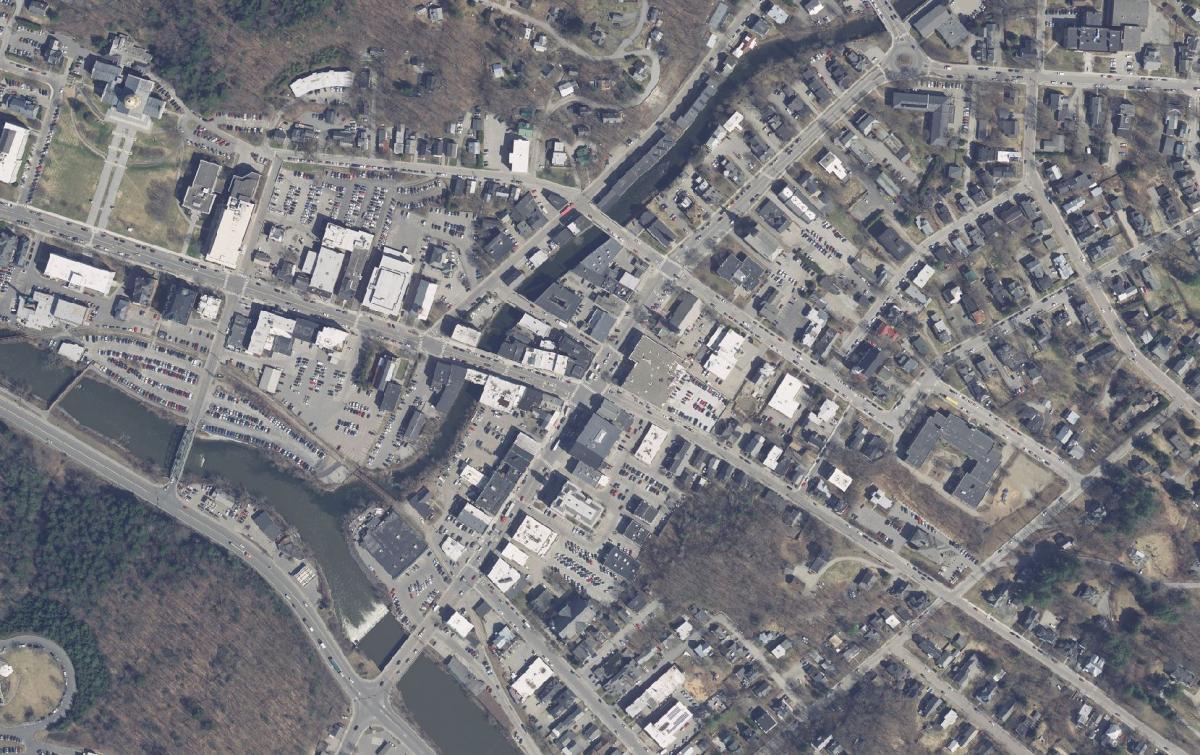
Montpelier 2018 from the 15cm color imagery collection.
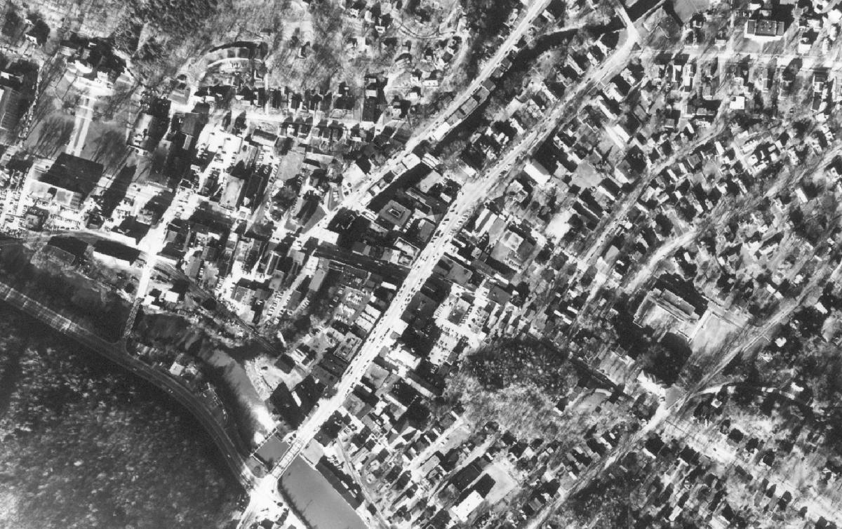
Montpelier 1962 from the 1962 "L" collection.
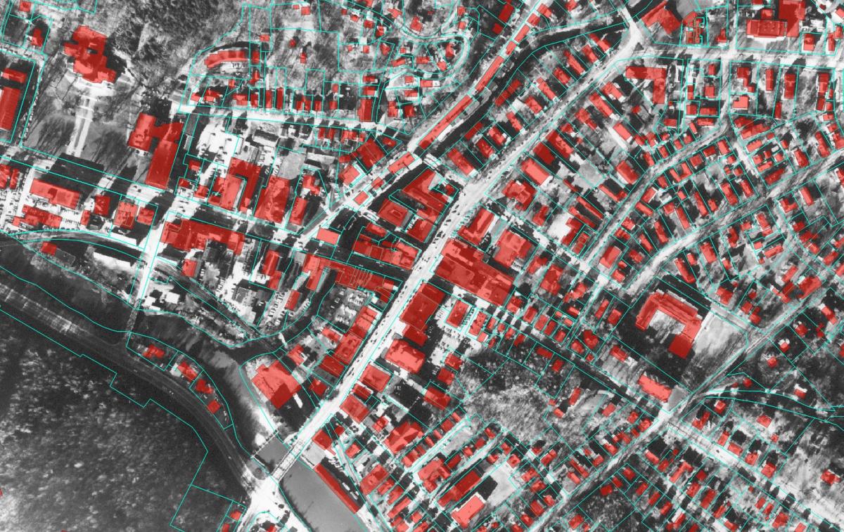
Present-day parcel and building data over a georeferenced example of the 1962 "L" collection photo above.
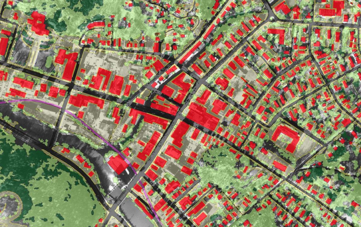
Impervious surfaces and tree canopy layers from the 2016 high-resolution land cover set over a georeferenced example of the 1962 "L" collection photo above.