What is a Cloud Optimized GeoTIFF (COG)?
- It is just a GeoTIFF raster file.
- No additional GIS software is needed to use them.
- It is optimized for performance.
- Tiles: Internal 'tiles' inside permit faster access
- Overviews: Internal 'down-sampled' versions
- It is streamable.
- Just the bytes needed are sent to your machine via internet connection.
Combined with compression, these factors create a high performance streamable GeoTIFF with full access to pixel values and multiple bands. In a way it can be thought of as a raster data download type with streaming web service-like functionality, all in one.
COG Storage and Access
VCGI's COGs are stored on an Amazon S3 (AWS S3) bucket in folders organized by Vermont Spatial Data Infrastructure (VSDI) theme. For example, COGs of lidar-derived elevation products are under the 'elevation' theme, orthoimagery products under the 'imagery' theme.
Note: if you click on a COG (.tif) when accessing the bucket via a web browser, the browser will download the file. See Adding COGs to your desktop GIS for instructions on how to access COGs in ArcGIS Pro or QGIS to avoid this behavior (unless you want to download the entire file.)
How to add COGs to ArcGIS Pro (3.x)
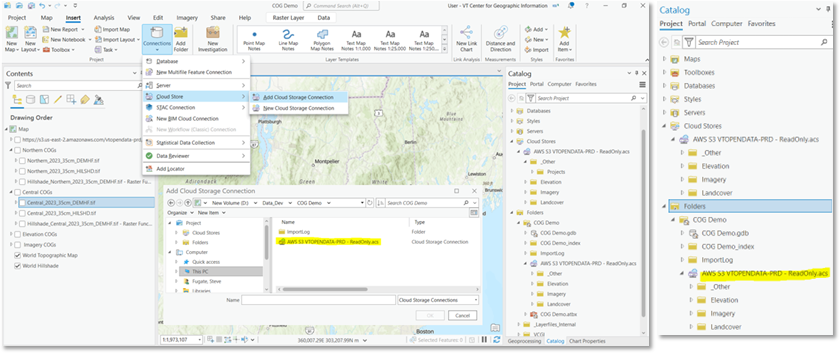
An ArcGIS Pro "cloud storage connection file" (.acs) is used to connect to VCGI's AWS S3 bucket.
- Save the connection to your "favorites" or "new projects" so that you can easily find it.
- .acs files can also be saved to a folder and then connected as if it were another folder.
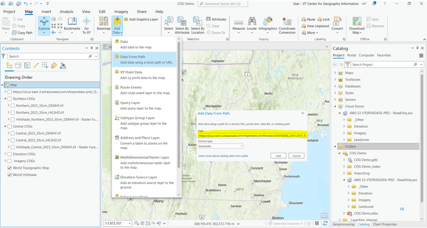
COGs can also be added directly to your Pro project by pasting the URL into the Add Data From a Path dialog window.
How to add COGs to QGIS
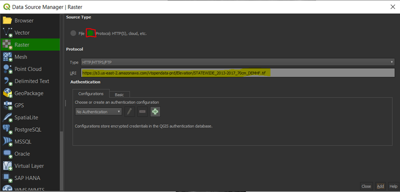
COGs can be added directly to your QGIS project by pasting the URL into the Data Source | Raster dialog window.
How to Clip and Extract COGs to a Custom Extent
Once you've added the COG to your ArcGIS Pro or QGIS session you can use the methods below to clip and extract the data to your local computer. Note: It is best to limit the extent of what you’re trying to clip and extract to manage the size of the download.
ArcGIS Pro
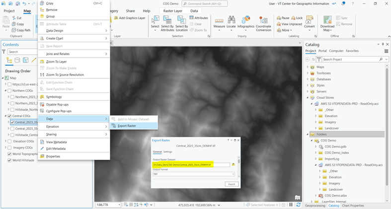
Zoom to desired extent, then Export Raster.
QGIS
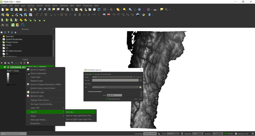
Zoom to desired extent, then Save Raster Layer As
