VT GIS Users,
Happy New Year!
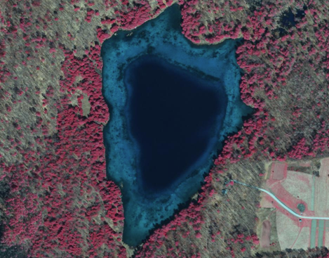
Just a reminder that VCGI will be pulling-the-plug on the deprecated “Best of” Color Infrared (CIR) Imagery services as noted below. It didn’t happen when the ball dropped on 12/31/2018, but it will happen tonight.
Feel free to reach-out to yours truly if you have any questions/concerns.
--
Steve Sharp - PMP, GISP
GIS Operations Manager
Vermont Center for Geographic Information
802-882-3006
vcgi.vermont.gov
http://www.linkedin.com/in/stevesharp
Vice President, GIS Certification Institute (http://www.gisci.org)
From: Sharp, Steve
Sent: Monday, December 3, 2018 9:45 AM
To: 'vgis-l@list.uvm.edu' <vgis-l@list.uvm.edu>
Cc: EGC - Statewide GIS Group <SOV.EnterpriseGISConsortiumGroup@vermont.gov>
Subject: VCGI NOTICE: Old CIR Services will be retired on 12/31/2018
VT GIS Users,
As noted in the thread below, VCGI has improved the performance of its “Best of” Color Infrared (CIR) Imagery services by pre-caching (tiling) the imagery. This resulted in the release of two new image services back in September, one in Vermont State Plane Meters (SP) and the other in Web Mercator (WM).
The REST endpoints are available here http://geodata.vermont.gov/datasets?q=Composite%2C%20ColorInfrared%2C%20nodeVCGI&t=itemtypewebservice
|
IMPORTANT NOTICE: The following will be discontinued on 12/31/2018 per our Life Cycle Policy http://maps.vcgi.vermont.gov/opendata/lifecycle/VCGI_AGS_LifeCyclePolicy.pdf.
Users should make plans to migrate their apps and projects over to the new services between now and 12/31/2018. |
Feel free to contact us if you have any questions or concerns.
--
Steve Sharp - PMP, GISP
GIS Operations Manager
Vermont Center for Geographic Information
802-882-3006
http://www.linkedin.com/in/stevesharp
Vice President, GIS Certification Institute (http://www.gisci.org)
From: Sharp, Steve
Sent: Thursday, September 20, 2018 3:01 PM
To: 'vgis-l@list.uvm.edu' <vgis-l@list.uvm.edu>
Subject: New cached Color Infrared imagery services
VT GIS Community,
VCGI has improved the performance of its “Best of” Color Infrared (CIR) Imagery services by pre-caching the imagery, matching what we’ve do for our True Color and Black and White imagery services. This has resulted in the release of two new image services, one in Vermont State Plane Meters (SP) and the other in Web Mercator (WM).
The REST endpoints are available here http://geodata.vermont.gov/datasets?q=Composite%2C%20ColorInfrared%2C%20nodeVCGI&t=itemtypewebservice
TIPS:
- The Web Mercator version should be used in web or mobile mapping apps. The State Plane version is best for those working in State Plane (eg: in ArcGIS Desktop or QGIS).
- Learn how to find, access, and use our web map services here https://www.youtube.com/watch?v=5cZQEg88-5s&index=5&t=0s&list=PLMg5UHByMftdglMUWsqMp22nEtF5jqG1P
- You can bypass the cache as needed by using the OGC WMS access method or by toggling “Enable Cache View Mode” in ArcGIS.
- Use the WMTS endpoint to access the cached tiles if you’re using Open Source software such as QGIS. Use WMS to bypass the tiles.
|
IMPORTANT NOTICE: These new services will replace our existing non-cached CIR imagery services per our Life Cycle Policy http://maps.vcgi.vermont.gov/opendata/lifecycle/VCGI_AGS_LifeCyclePolicy.pdf. The following will be discontinued on 12/31/2018.
Users should make plans to migrate their apps and projects over to the new services between now and 12/31/2018. |
I hope you enjoy the new services.
Reach out to me if you have any questions on concerns.
--
Steve Sharp - PMP, GISP
GIS Operations Manager
Vermont Center for Geographic Information
802-882-3006
vcgi.vermont.gov
http://www.linkedin.com/in/stevesharp
Vice President, GIS Certification Institute (http://www.gisci.org)
