Base land cover and other supplementary land cover layers are now available for download and streaming at the Vermont Open Geodata Portal. The 2016 statewide, high-resolution land cover products are created from a combination of 2013-2017 lidar data and 2016 orthoimagery. Full details about the products, source data, methodology, and limitations are available in the accompanying report and documentation.
The high-resolution land cover datasets serve as a key component of and addition to Vermont’s Spatial Data Infrastructure that includes orthoimagery, lidar-derived elevation products, and grand list-joined parcel data.
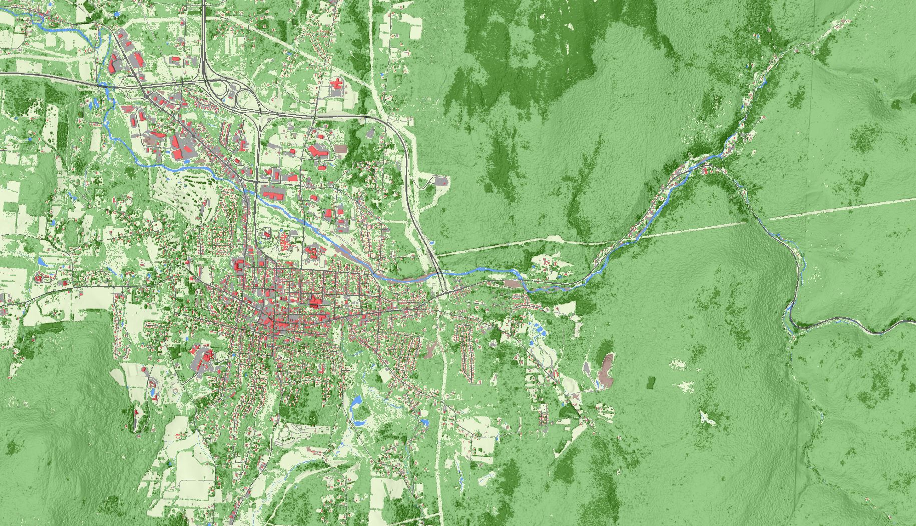
Available products with statewide coverage include:
- Base Land Cover: A raster product with a 0.5-meter resolution. This layer contains 8 classes: tree canopy, grass/shrubs, bare soil, water, buildings, roads, other paved, and railroads. This is the foundational, “top-down” created land cover product from which supplemental layers below are derived.

Example of the base land cover layer in an urbanized area. Image: UVM Spatial Analysis Lab
- Supplemental Land Cover: Vector products that include shrub, agricultural, and wetland land cover types as individual layers. These are standalone delineations of base land cover features.

Example of the agriculture supplemental land cover layer. Image: UVM Spatial Analysis Lab

Example of the wetland supplemental land cover layer. Image: UVM Spatial Analysis Lab
- Tree Canopy: Vector product that refines the base land cover canopy class into individual tree canopy polygons and classes them as either deciduous or coniferous.

Example of the tree canopy land cover layer depicting deciduous and coniferous classes. Image: UVM Spatial Analysis Lab
- Impervious Surfaces: Vector product created through a “bottom up” approach to map surfaces obscured by tree canopy. Includes buildings, roads, other paved, bare soil, and railroad classes.

Example of the impervious surfaces land cover layer. Image: UVM Spatial Analysis Lab
- 3D Building “Roofprints”: Vector product of building roofprints from the impervious surfaces layer attributed with height information derived from LiDAR data.

Example of the 3D Building Roofprints layer viewed with imagery, contour, and parcel data.
For questions or more information, see documentation and reports at the land cover page at the VT Open Geodata Portal.