Lidar Use Cases Slideshow
Lidar Program
Airborne Light Detection and Ranging (LiDAR) technology is used to acquire high accuracy elevation data of the earth's surfaces. VCGI's Lidar program coordinates the collection, processing, and publishing of these elevation data and their derivative products that span the state of Vermont.
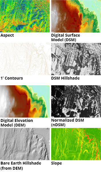 Example lidar-derived, statewide data products made available by the program include: