Pilot Area Data Now Available
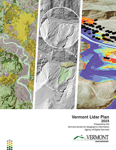
VCGI is pleased to announce the forthcoming availability of statewide quality level 1 (QL1) airborne lidar-derived elevation products for all of Vermont in 2024. The entire state was captured in Spring 2023, reflecting for the first time a statewide collection in a single season. The release will also represent an update to existing quality level 2 (QL2) lidar-derived elevation products captured between 2013 and 2017, enabling comparison between the collections. New data products and services are part of United States Geological Survey's 3D Elevation Program (USGS 3DEP), are supported by the USGS under Grant/Cooperative Agreement No. G23AC00363-00 and are being guided by input from technical advisors and partners as depicted in the 2023 Vermont Lidar Plan (PDF; also displayed below).
Future data release notices will provide more detail on these products as they become available. Stay tuned to vcgi.vermont.gov/articles for more information in 2024.
Forthcoming Products
The newly captured source point cloud is expected to exceed USGS 3D Elevation Program requirements for the QL1 Lidar Base Specification, which equates to at least 8 pulses per square meter, a four-fold increase in capture density over existing QL2 data (2 pulses per square meter). This will result in derived elevation products of greater clarity and detail.
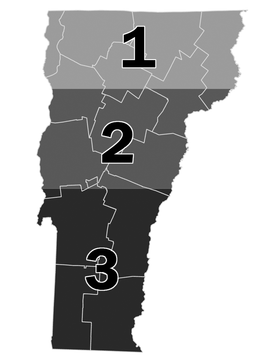
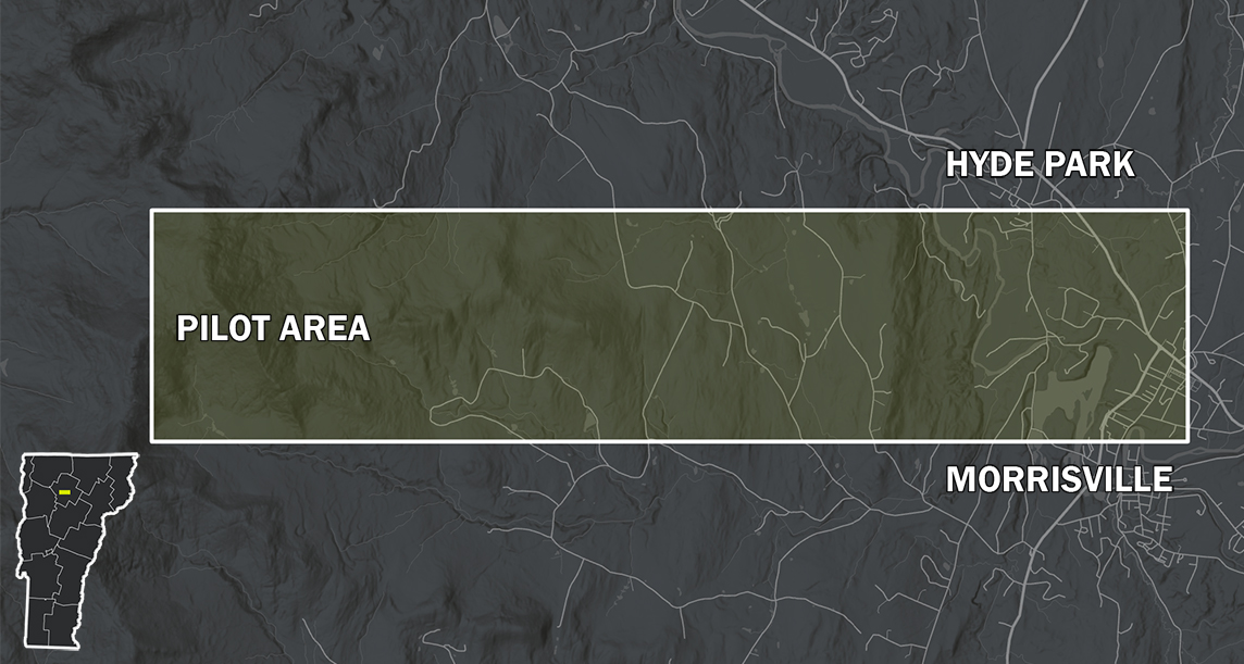
The following products are expected to be released in 2024 on a rolling basis, first as preliminary data in the 3 geographies at right, then as single statewide layers pending final USGS approval.
- Classified Point Cloud
- Hydro-Flattened Digital Elevation Model (DEM)
- Digital Surface Model (DSM) for first and last returns
- Normalized Digital Surface Model (nDSM)
- Bare Earth Hillshade
- 1-foot Contours
Several additional lidar-derived products are also expected to be available:
- Height Models
- Topographic Derivatives (e.g., Geomorphons)
- 3D Buildings
- Tree Crowns
- Tree Canopy Change
- Enhanced Point Cloud Classification
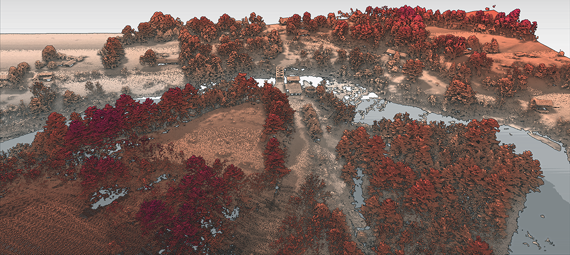
View the below comparisons of existing QL2 data with preliminary QL1 data in the same location to get a sense of the improvements to come:
Drag the slider to compare details in the existing QL2 bare earth hillshade with the preliminary QL1 bare earth hillshade for the same location. Determining which is which should be clear: the forthcoming QL1 data delivers more detail.
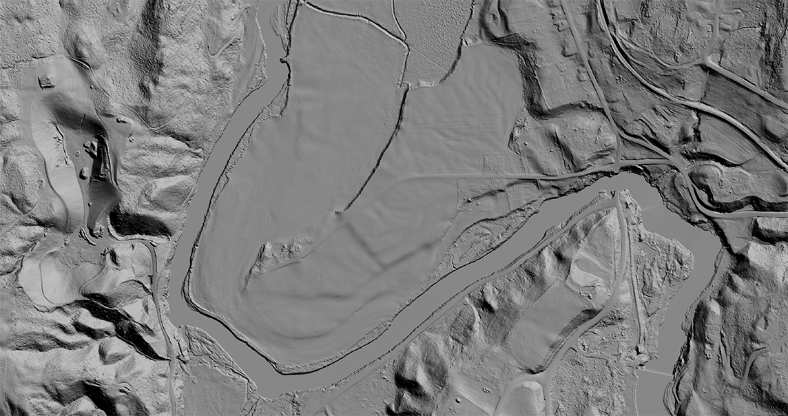
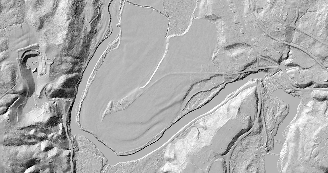
In this pair of images the top one displays a preliminary bare earth hillshade product for the pilot area at the forthcoming QL1 resolution (open at full res in new tab). The second image below depicts the same area in the current QL2 resolution (open at full res in new tab). Be sure to view them at full resolution.
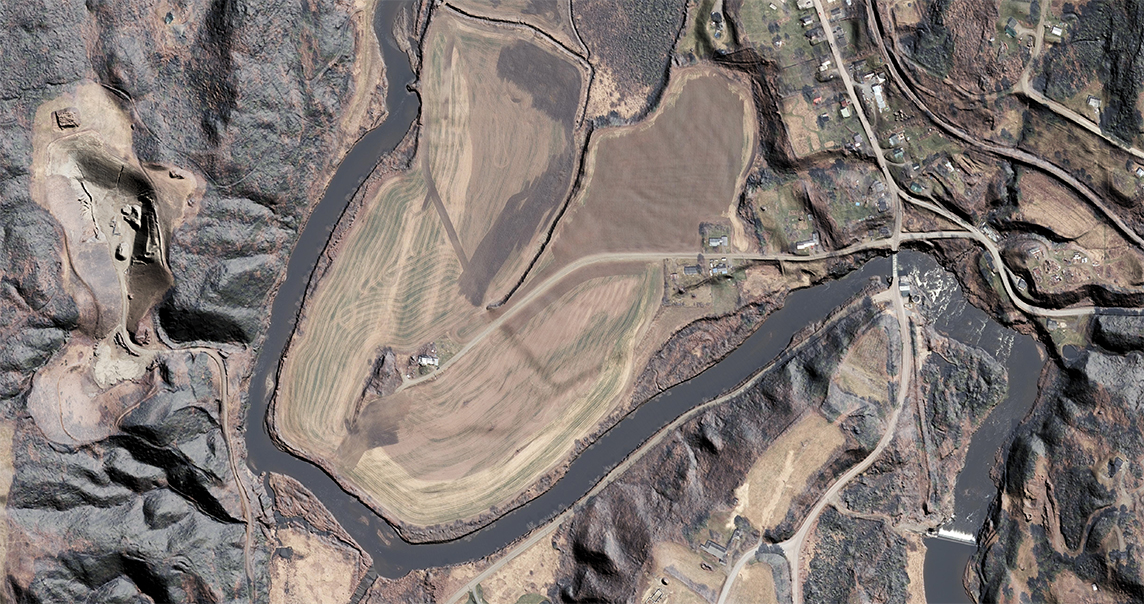
The same QL1 hillshade product with current, best of imagery applied as an overlay highlights the increased amount of detail in the forthcoming lidar-derived products (open in full res in new tab).
Pilot Data Now Available
Select products from the new collection are now available to preview for a location near Morrisville, VT:
- QL1 Point Clouds in .las format (Directory)
- QL1 Point Clouds in Cloud Optimized Point Cloud (COPC) format (Directory)
- QL1 Bare Earth Digital Elevation Model (DEM) as a Cloud-Optimized GeoTIFF (COG) (Directory / Download-Stream URL)
- QL1 First Return Digital Surface Model (DSM) as a Cloud-Optimized GeoTIFF (COG) (Directory / Download-Stream URL)
- QL1 Last Return Digital Surface Model (DSM) as a Cloud-Optimized GeoTIFF (COG) (Directory / Download-Stream URL)
- QL1 Normalized Digital Surface Model (nDSM) as a Cloud-Optimized GeoTIFF (COG) (Directory / Download-Stream URL)
- QL1 Bare Earth Hillshade as a Cloud-Optimized GeoTIFF (COG) (Directory / Download-Stream URL)
- QL1 Pilot Product Parent Directory
Cloud-optimized GeoTIFF’s (COGs) are a kind of hybrid data download and streamable service in one. See this article for more information on how to reference a COG in QGIS via a streaming connection (as opposed to a download). COGs may also be downloaded and referenced as a typical GeoTIFF raster.
More Information
See the 2023 Vermont Lidar Plan (PDF) and VCGI’s Lidar Program for more information. Existing lidar-derived GIS data are published at the Vermont Open Geodata Portal's elevation page. Questions? Contact VCGI’s Lidar Program Manager Steve Fugate at steve.fugate@vermont.gov.
Acknowledgements
VCGI would like to thank the Enterprise GIS Consortium (EGC) and the Lidar Steering Committee for their guidance on this upcoming release, as well as the USGS and Vermont Agency of Transportation for their funding support.
![]()