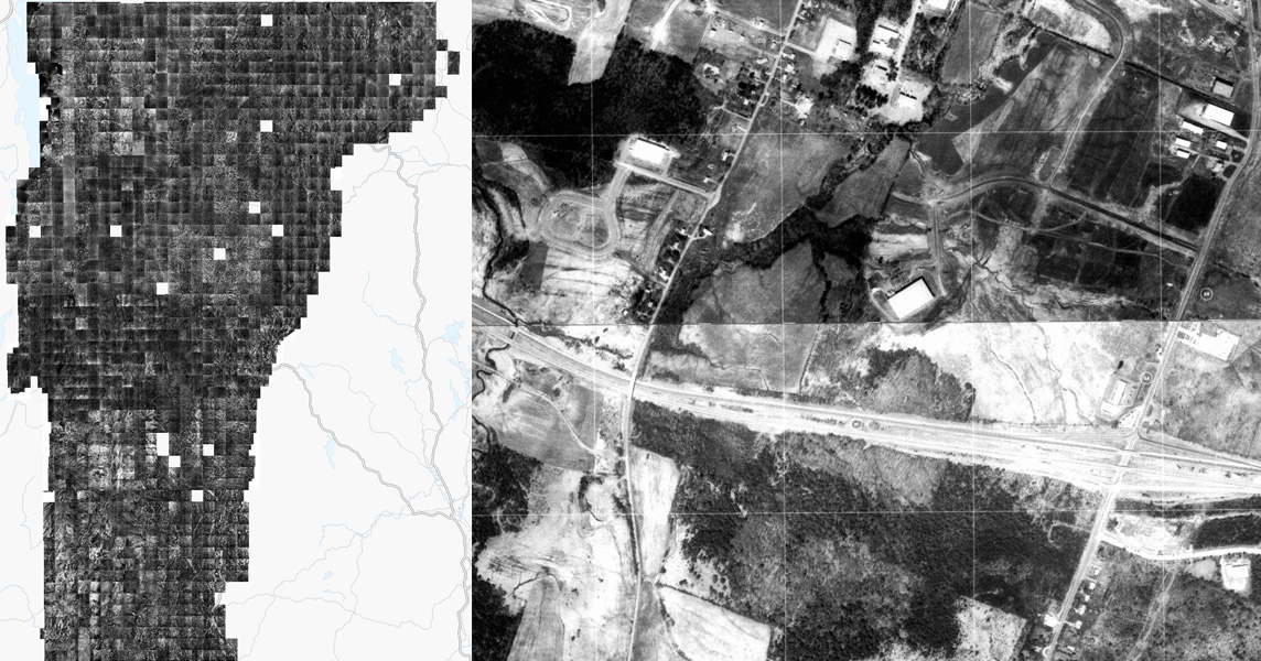
The Vermont Imagery Program (VIP) is pleased to announce the availability of 1:5000 scale Vermont orthophotos acquired between 1974 and 1992 by the Vermont Mapping Program (previously part of the VT Tax Department, disbanded in 2009).
This was the first vintage of statewide orthophotos (orthorectified aerial photos) captured by the State, which up until now had only been available in analog form (paper, mylar). Mylar versions were scanned and georeferenced by Heindel & Noyes (now Waite-Heindel Environmental Management) in the early 2000s to support their consulting work. In 2025 Waite-Heidel gave the State of Vermont permission to release the scanned orthophotos in the public domain. Special thanks to Heindel & Noyes for the original scanning and georeferencing work and to Waite-Heindel for the public release.
Data Access
These scanned orthophotos are available for download and streaming from the imagery page at the VT Open Geodata Portal, including the following products:
Image Service
Downloads
Index
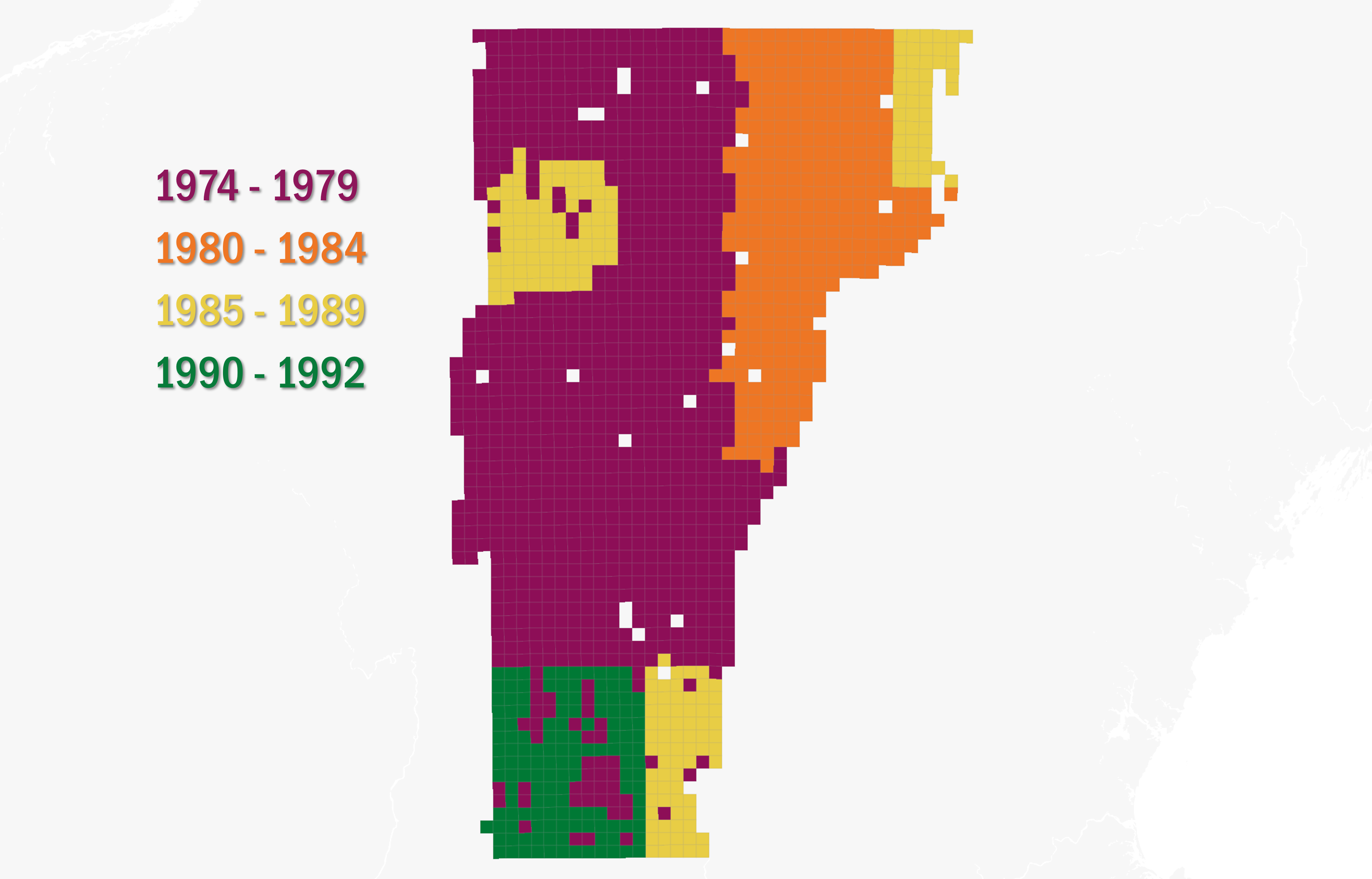
Data Coverage and Dates
The data cover most of Vermont and span nearly two decades of collection times. Holes in coverage reflect where images could not be located and/or were not scanned. Please see the metadata about uncertainty regarding acquisition year, and associated alternative year assignment and notes within the dataset.
Preview in Relation to Current Orthoimagery
Questions?
Please see the Vermont Imagery Program and its FAQ's, or contact Steve Sharp, imagery program manager.